
Lodgepole Pine at Crater Lake: History and Management of the Forest Structure
Appendix C
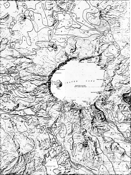
Distribution of plant communities in Pinus contorta forest in Crater Lake National Park. Heavy black lines correspond to the boundaries of the principal P. contorta stands. “X” signifies non-P. contorta surrounded by P. contorta. Each grid unit in the eastern part of the Park is one mile square. All maps are to the same scale (from Zeigler, 1978).
Communities:
1 = Calocedrus decurrens/Arctostophylos
2 = Pinus contorta/Purshia/Carex
3 = Pinus contorta/Carex-Stipa
4 = Pinus contorta/Carex-Lupinus
5 = Abies concolor/Bromus carinatus – Lupinus
6 = Abies lasiocarpa/Collomia-Lathyrus
7 = Abies lasiocarpa/Haplopappus/Aster-Elymus
8 = Abies magnifica var. shastensis – Tsuga mertensiana/Carex-Lupinus
9 = Mixed Conifer/Arctostaphylos-Purshia/Carex
10 = Tsuga mertensiana/Vaccinium
11 = Mixed Conifer/Arctostaphylos
***previous*** — ***next***