

Volume 10 No. 2 – July 1, 1937All material courtesy of the National Park Service.These publications can also be found at http://npshistory.com/Nature Notes is produced by the National Park Service. © 1937 |
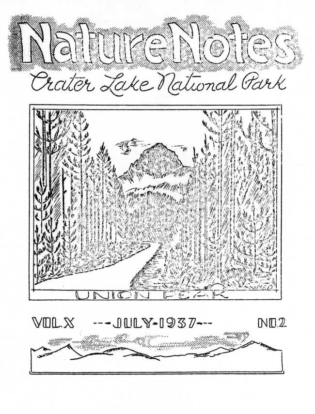
Cover Design – Nancy Elliott Doerr
Preface
Crater Lake National Park
The park includes an area of 250 square miles on the crest of the Cascade Range in southern Oregon. The area was established as a national park in 1902, preserving the unsurpassed scenic beauty of Crater Lake, a deep lake, the clear fresh water of which reflects and refracts unusual hues of blue. Color is only one of the elements of the inspiring beauty of Crater Lake. Its setting is unique. The lake, having an area of 20 square miles, is cupped within the crater of an extinct volcano. Cliffs 500 to 2000 feet high completely surround the lake. The crater walls are partially mantled with hemlock, fir, and pine trees. On the gentle outer slopes of the mountain which one ascends in approaching Crater Lake there are deep canyons, magnificent forests and open meadows supporting a colorful display of mountain wild flowers. Hiking and fishing are popular outdoor sports during the summer months. Skiing is popular in the winter, and the park being accessible throughout the winter months by the west entrance road from Medford and the south entrance road from Klamath Falls.
Oregon Caves National Monument
This national monument, an area of 480 acres, is located in the Siskiyou Mountains in southwestern Oregon. The caves, named “The Marble Halls of Oregon” by Joaquin Miller, are truly marble halls. Underground water penetrating to great depth along fractures in the marble formation has dissolved out an extensive system of chambers. Water dripping from the ceiling and walls has decorated the halls and passageways with fantastic stalactites and stalagmites which stimulate one’s imagination as well as one’s appreciation of the beauties of nature in caverns never touched by sunlight. In the magnificent forest around the cave entrance there are trails along which one gets inspiring views of forest-covered mountains and valleys. Along the trails one can observe many species of trees, mammals, and birds.
Lava Beds National Monument
Located in northeastern California, the monument includes an area of 45,000 acres. As the name suggests, volcanic formations, some of quite recent origin, are of greatest importance. There are hundreds of lava tubes which were once the passageways for streams of molten lava. Volcanic cones rise above the general level of the adjacent country. There are excellent examples of “aa” and “pahoehoe” lava flows. Within the monument there are interesting historical features including battlefields of the Modoc War of 1872-73. There are important ethnological and archaeological features. Petroglyphs on cliffs and pictographs in caves are evidence that the region was inhabited by primitive people long before the coming of the white man.
The Geology Of Union Peak
By Carl E. Dutton, Ranger Naturalist

Union Peak is the most conspicuous topographic feature in the southwestern portion of the park, its summit being 7698 feet above sea level and over 1000 feet above the general level of the adjacent area. The upper 800 feet of the peak stands as a rock spire above a ridge-like base which is the drainage divide between Union Creek to the north and Red Blanket Creek to the south, both streams being tributaries of the Rogue River. Union Peak is visible from many parts of the park. From almost any viewpoint it is symmetrical in outline, being somewhat like an inverted “U”. The summit of the peak is a ridge 50 feet long from east to west and about 15 feet wide from north to south. A sketch of a view of Union Peak appears on the cover of this issue of Nature Notes.
The relatively simple structure of Union Peak is the key to its geology. The spire of the peak consists of a gray igneous rock the minerals of which are too small to be recognized without magnification. This central rock mass has been broken into blocks by systems of fractures which probably formed as the mass solidified and cooled. There are relatively few blocks even closely resembling the typical six-sided columns which usually form as hot igneous masses cool and contract. There is general radial arrangement of the planes of fracture in the spire-like mass of the peak.
Although most of the spire is composed of the fine grained gray rock, on the eastern side near the summit there is an area or mass of very different material. The material is dark dray to black. It consists of fragments of various sizes arranged in poorly defined layers whose inclination is toward the west, that is, toward the central portion of the peak.
Structures exposed around the base of the peak are also significant. At the eastern side of the peak there is an area in which a layered arrangement of material is also evident. These layers are composed of numerous angular fragments, varying widely in size, and a great proportion of very fine material. The layers are inclined steeply toward the east.
At the western base of the peak layered material is exposed. Those layers, the top and bottom of each being irregular and rough, do not show any fragmental characteristics. The inner portion of each layer is composed of rather uniformly fine grained, dark gray to black rock.
Union Peak is described in Professional Paper No. 3 as being of volcanic origin.* The description states that the spire or central portion of the peak represents lava which rose and solidified in the vent of a volcano. Such a conclusion must have been based on the exposed structures, described above. The layered fragmental material at the eastern base of the peak is a portion of the cone having been removed by erosion. The material at the western base of the peak represents a portion of the cone which was built by successive outpourings of lava flows.
The black cindery material near the summit of the peak represents an interesting relationship. The usual inclination of layers in a volcanic cone is outward from the center; however, in the mass near the summit the inclination is toward the center. Because of this relationship to the central spire the mass of cindery material may represent explosive fragments which fell on the inward facing slope within the crater of the cone, the inclination of layers having been controlled by the slope of the wall of the crater.
The structure visible at Union Peak indicate that it was a center of volcanic activity. The present physical features of the peak are the result of processes which acted since the cone was built by volcanic activity. Glaciers and running water are in part at least responsible for the partial destruction of the former cone which may have stood at an elevation somewhat higher than the present peak.
Just north of the peak there are several broad flat valleys. These are obviously of glacial origin. Valleys of similar origin exist to the south and west of the peak. It has been shown that Union Peak is a remnant of a once larger cone. The fact that the lower slopes show evidence of glaciation also indicates that the peak was at one time sufficiently large to permit a heavy accumulation of snow which fed the glaciers on the slopes of the peak, glacial action having cut the U-shaped valleys to the north, south, and west. The isolated position and the spire-like character of the remaining portion of the cone is perhaps a measure of the extent to which material was removed by glaciation. The materials composing the cone would be much more easily eroded than the solid mass of rock which filled the central vent of the cone. By repeated glaciation the material of the cone was evidently stripped away from the “plug”.
Union Peak is also of interest because of several detailed features. The blocks of rock in the talus on the southeastern and southwestern sides contain in abundance a mineral whose chemical composition is identical to that of quartz, but whose physical properties are sufficiently different that this variety is designated as cristobalite. This mineral was first discovered in Mexico and has since been found at relatively few places in the world. It is thus rather surprising to find the mineral in such abundance at Union Peak. Although the crystals are seldom more than 1mm in their greatest dimension, they are well formed double-ended four-sided pyramids. The crystals formed as coatings in the cavities of the rock, evidently having been deposited from solution which filled or passed through the cavities.
Blobs of glass occur on fragments of rock at the summit of the peak. The glass is present on some fragments which are apparently the result of residual disintegration, and also present on fragments at the top of a crudely built “monument”. The blisters of glass are distinctly surficial phenomena. The only logical explanation seems to be that fusion has been produced by strokes of lightning hitting the peak.