
Pinnacles Road
Almost all construction on the Pinnacles Road took place in 1913, when laborers and teams completed clearing, rough grading, and cross drainage for the 6.5 miles between the East Entrance and Kerr Notch. The last 1.5 miles nearest the rim required some side hill excavation because the road’s location remained close to Sand Creek until it approached the Anderson Bluffs.
The only subsequent changes to the road while the engineers remained at Crater Lake came in 1918, when the two bridges and nine wooden culverts were replaced with fills and corrugated iron culverts. It remained a rough graded road, one that required continual regrading due to the ruts caused by traffic, particularly trucks hauling supplies. Regrading took place on an annual basis for the next decade or so, beginning in 1914.
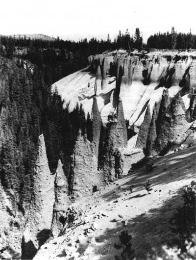
Early National Park Service photo of the Pinnacles.
|
Pinnacles Road 6.2 mi |
|
|
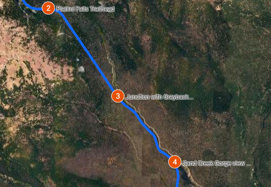
Junction Pinnacles/East Rim Drive (mile 0.0). The road to the Pinnacles drops down the valley along the base of a sheer cliff out of which Rim Drive has been chiselled and can be seen above. The talus along the base is kept moist by much water seepage in which bright green Pacific red elder bushes flaunt corymbs of creamy-white flowers that are followed by brilliant, shiny crimson berries. The slope is overwhelmed by deep rose Lewis monkeyflowers, in company with bleedginghearts, arnicas, asters, and fleabanes. The forest of hemlocks and firs that grows on Kerr Notch is soon replaced by one of almost pure lodgepole pines. The glaciers that cut this valley had been reduced by the time of the climax eruptions to a thin tongue of ice that extended only a short distance, possibly a mile, below the present rim. The geological history of Sand Creek Valley that is followed by the road is similar to that of Annie Creek. |
|
|
Grayback Motor Nature Drive (mile 3.1) |
|
|
|
-

Lost Creek Campground (mile 3.2). Operated by the National Park Service, Lost Creek Campground contains 16 sites for tent camping only. It is located in the southeast corner of the park, three miles south of east rim drive on Pinnacles Road. It is, generally, open from late May through early-October, weather permitting. The campground tends to fill on weekends, but usually not before mid-afternoon. It offers running water, sinks, and flush toilets. Each site has a picnic table, fire ring, and a food locker. Payment can be made by cash or check. Holders of a Senior Pass or Access Pass receive a 50% discount. For further information, contact the National Park Service at 541-594-3100.

Sand Creek Gorge view (mile 3.7).
View of the narrow gorge of Sand Creek. This is cut into dark gray, columnar-jointed scoria, similar to Annie Creek.

Wheeler Creek (mile 5.3).
The small ravine which the road now crosses, rapidly becomes deeper. The spectacular pinnacles next described are on the slopes of the big canyon cut by this tiny stream, just before it empties into Sand Creek.

Pinnacles Overlook (mile 6)
***previous*** — ***next***