
Historic Maps of Crater Lake and Surrounding Area
Possibly the largest single collection of Crater Lake historic maps, and many of these are in the Crater Lake Institute Collection.
All enlarge with a click.
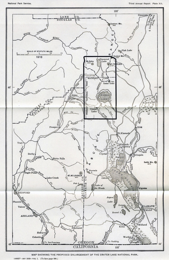
1919 Map Showing Proposed enlargement of the Crater Lake National Park
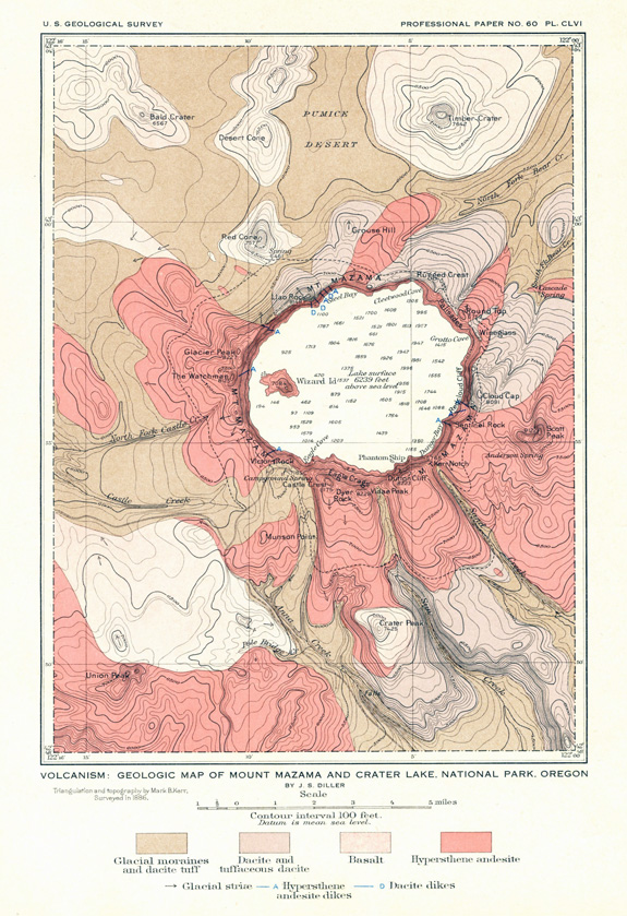
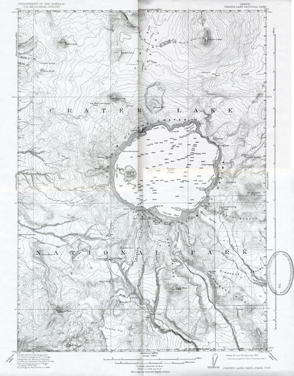
1908 Crater Lake, Oregon, Map, United States Geological Survey, Professional Paper No. 60, The Interpretation of Topographic Maps
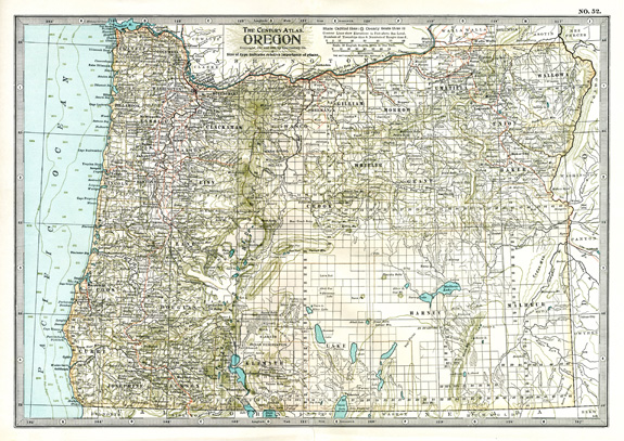
1902 New York Century Company Atlas map of Oregon
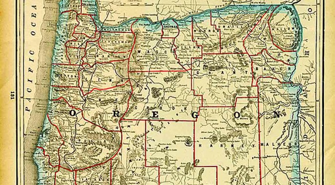
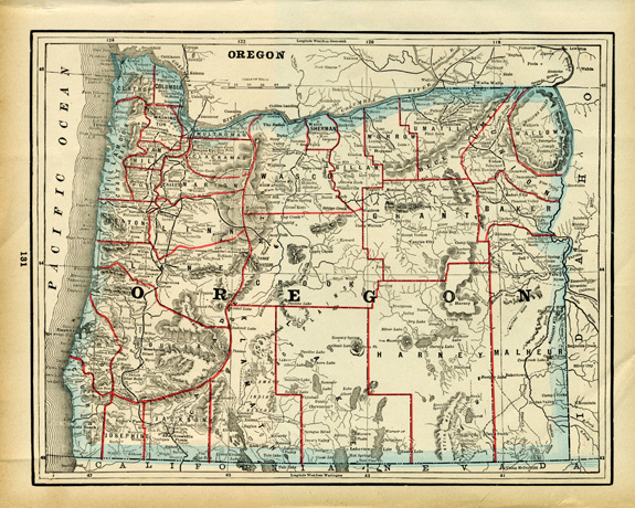
1893 Columbian World’s Fair Atlas of the World Map of Oregon
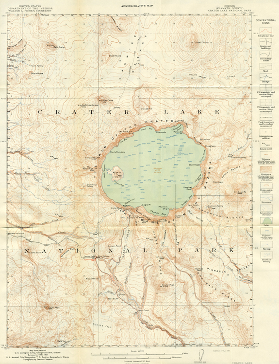
1911 Crater Lake National Park Administrative Topographic Map, Dept. of the Interior, U.S. Geological Survey
Reprinted 1925 Dept. of Interior, U.S. Geological Society, Crater Lake National Park Topographic Map
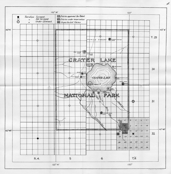
1904 Crater Lake National Park Plat Survey Map
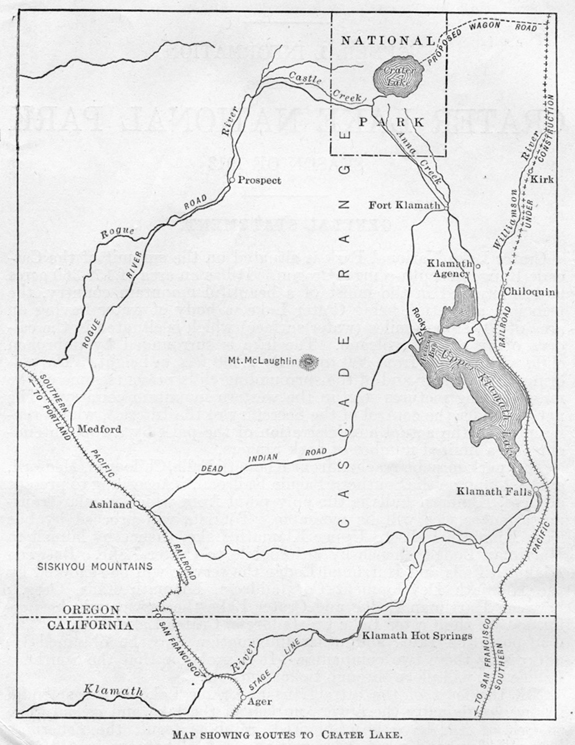
1913 Map Showing Routes to Crater Lake
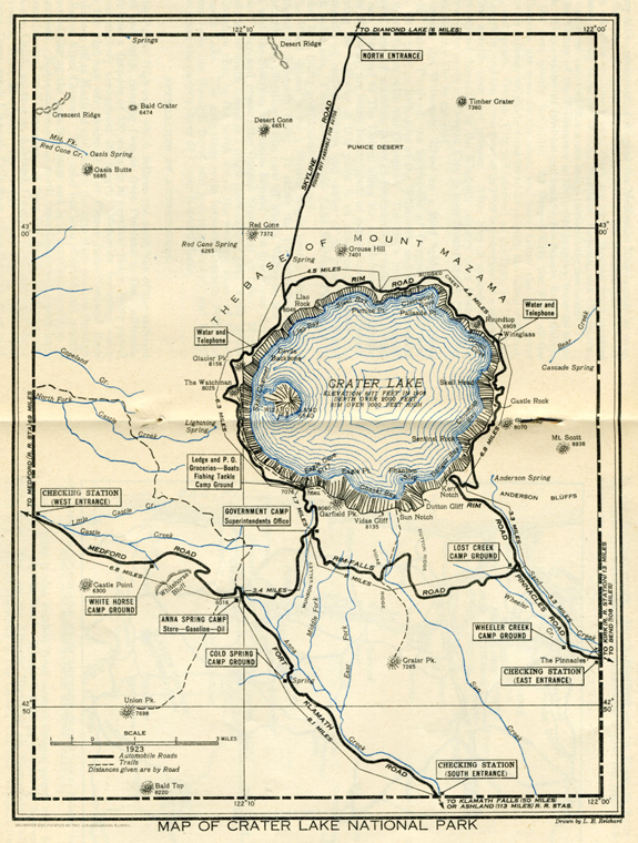
1923 Map of Crater Lake National Park
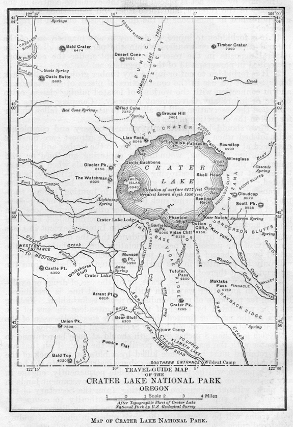
1913 Map of Crater Lake National Park
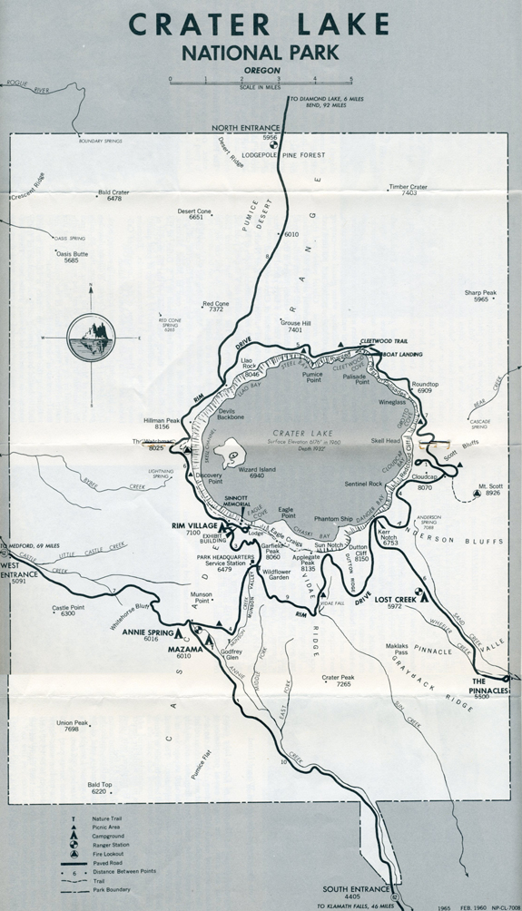
1965 Crater Lake National Park Map
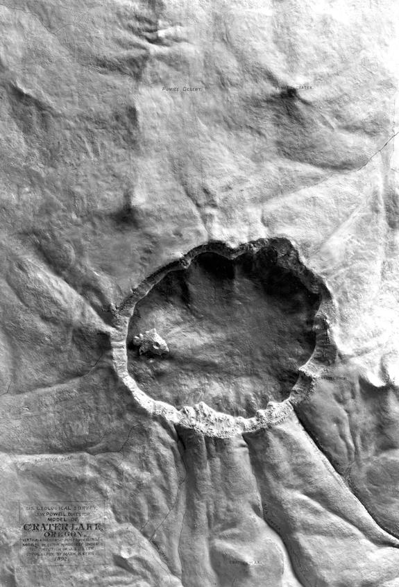
1892
Crater Lake National Park Model, U.S. Geological Survey
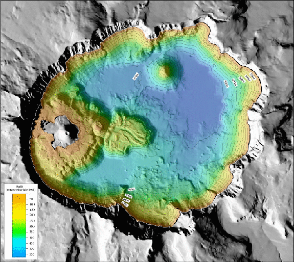
Shaded-Relief Bathymetry Image of Crater Lake, Oregon
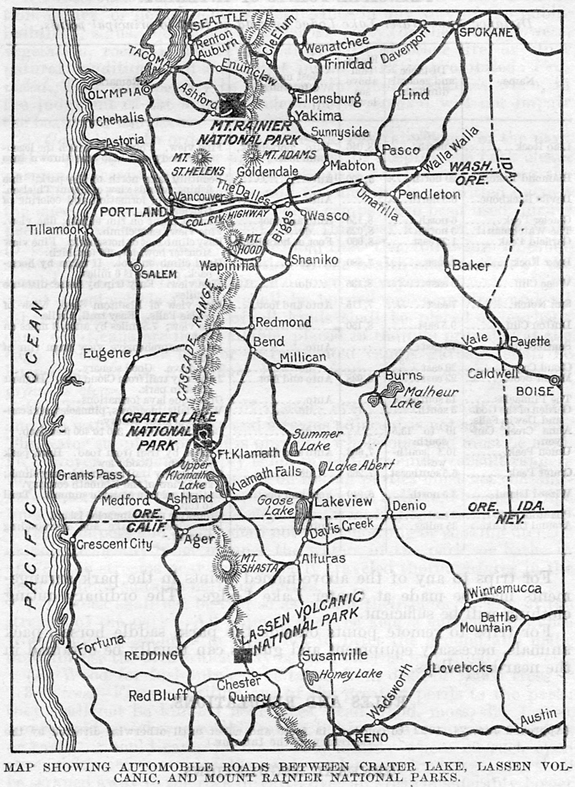
1923 Map Showing Automobile Roads Between Crater Lake, Lassen Volcanic, and Mount Rainier National Parks
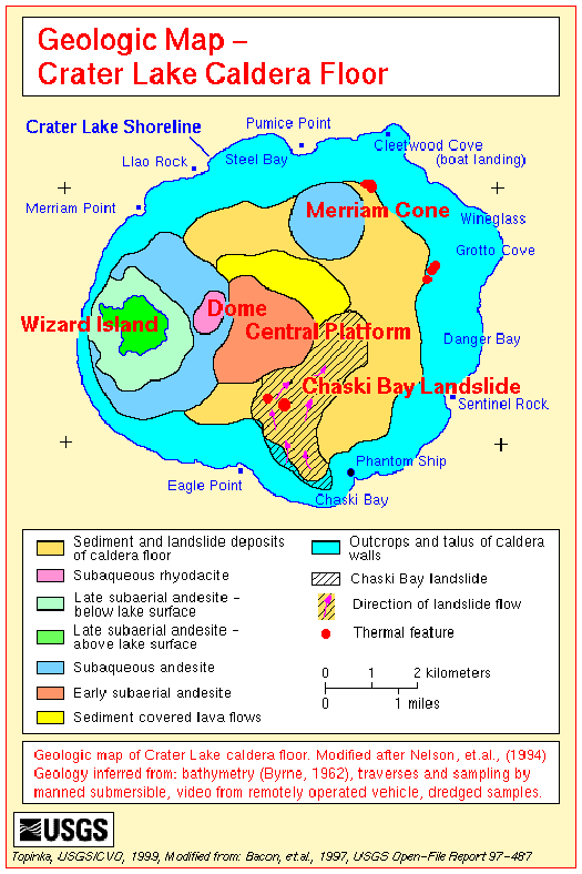
1997 Geologic Map of the Crater Lake Caldera Floor, United States Geological Survey
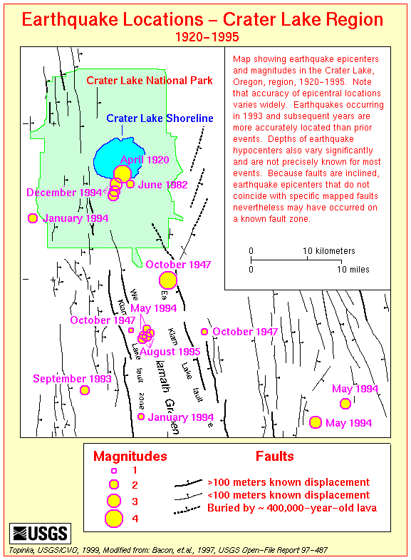
1997 Map of Earthquake Locations – Crater Lake Region, 1920-1925, United States Geological Survey
Other pages in this section
*** previous title *** --- *** next title ***