
For current conditions for Crater Lake National Park
Park Webcam and Weather Station page
Current Snow Depth website (come back when you’re finished there)
What’s the weather at Crater Lake right now?
Click here to view five Crater Lake live webcams
(will open in a new window)
Summer
The summer weather in Crater Lake National Park is usually mild with temperatures and clear skies except for occasional thunderstorms. During the warmest summer period, daytime temperatures are moderate and only occasionally exceed 85 degrees F. At lower park elevations, daytime temperatures may reach 95 degrees; however, after sunset, temperatures quickly drop and may reach 30 degrees (National Park Service 1924 to present). The park lies within the influence of the Pacific Ocean weather and the majority of storms that strike the north Pacific Coast each winter.
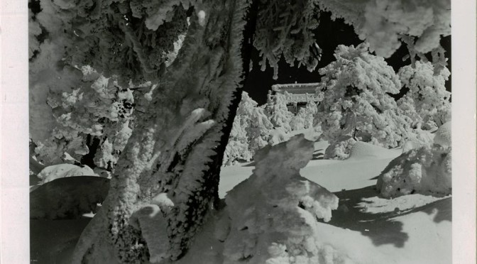
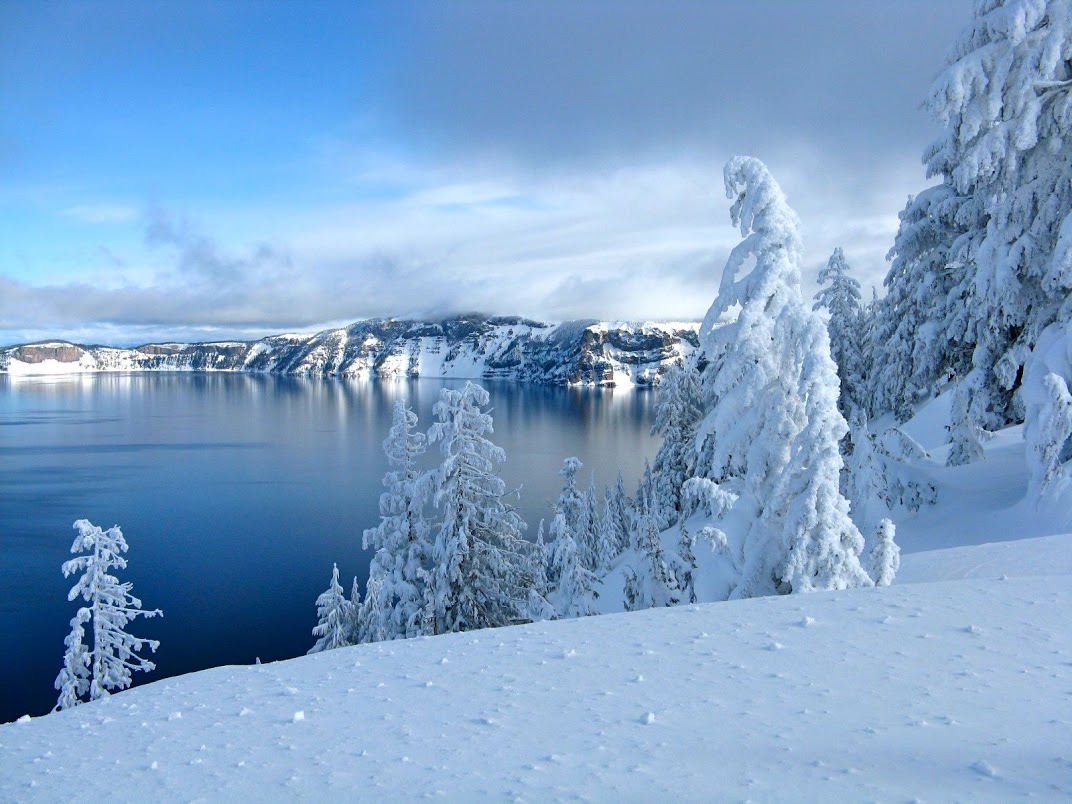
Seventy percent of the park’s annual precipitation occurs as snow from November through March. Average snowfall is 575 inches (48 feet), and snow depths of 100 to 200 inches (8 to 16 feet) are received each winter and are long lasting throughout much of the park. Daytime winter temperatures average slightly above freezing. Prevailing winds are from the northwest in summer and southwest in winter.
Crater Lake National Park Climate Information
Climate Averages
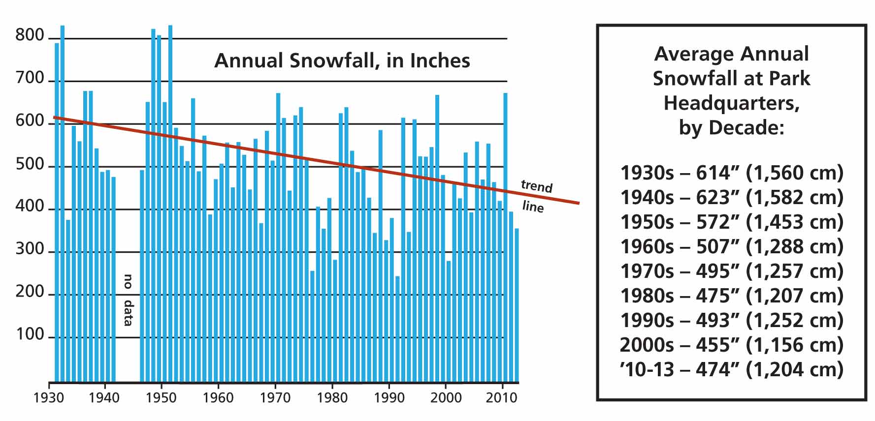
- Seasonal average snow accumulation: 524 in. (43.5 ft)
- Seasonal average (melted) precipitation: 66 in.
- Greatest total precipitation, 91.5 in., winter of ‘1981 – 1982
- Greatest seasonal snow accumulation: 834 in. (69.5 ft), winter of 1932 – 1933
- Greatest recorded snow depth: 252 in. (21 ft.), April 3, 1983
Less snow is falling in the park due to Climate Change
Snowfall at Crater Lake varies from year to year. Since 1931, however, when rangers first began keeping track, totals have been trending downward, and climate researchers expect the trend to continue. They predict the Pacific Northwest will experience even less snow and warmer temperatures in the decades to come.
Download the Park’s Climate Change brochure (PDF)
Climate-Change-at-Crater-Lake-2
or Crater Lake Climate Change Leaflet 2013
Where Is It Measured?
The U.S. National Weather Service maintains a precipitation gauge just north of the parking area for the Cleetwood Cove trailhead. The U.S. Geological Survey operates a water stage recorder on Crater Lake as a hydrological benchmark station at Cleetwood Cove. Snow survey courses are measured by the National Park Service for the Soil Conservation Service at Munson Valley and Annie Springs.
| Month | Average Maximum Temp. (F) | Average Minimum Temp. (F) | Average Total Precip. (inches) | Average Total Snowfall (inches) | Average Snow Depth (inches) |
| Jan. | 34.6 | 18.1 | 9.79 | 104.9 | 80 |
| Feb. | 34.8 | 18.6 | 8.51 | 83.8 | 104 |
| Mar. | 37.3 | 19.4 | 7.71 | 84.2 | 117 |
| Apr. | 41.9 | 22.2 | 5.50 | 44.9 | 112 |
| May | 49.0 | 27.5 | 3.51 | 20.1 | 77 |
| June | 57.4 | 33.3 | 2.06 | 3.8 | 24 |
| July | 67.3 | 39.7 | 0.99 | 0.2 | 1 |
| Aug. | 68.6 | 40.3 | 1.09 | 0.1 | 0 |
| Sep. | 62.2 | 36.1 | 2.05 | 2.8 | 0 |
| Oct. | 52.1 | 30.2 | 4.67 | 21.6 | 2 |
| Nov. | 37.2 | 21.8 | 10.47 | 63.6 | 17 |
| Dec. | 34.4 | 18.4 | 10.68 | 93.5 | 49 |
| Annual | 48.2 | 27.4 | 67.02 | 523.5 | 48 |
PARK WEBCAM AND WEATHER STATION PAGE
Other pages in this section