
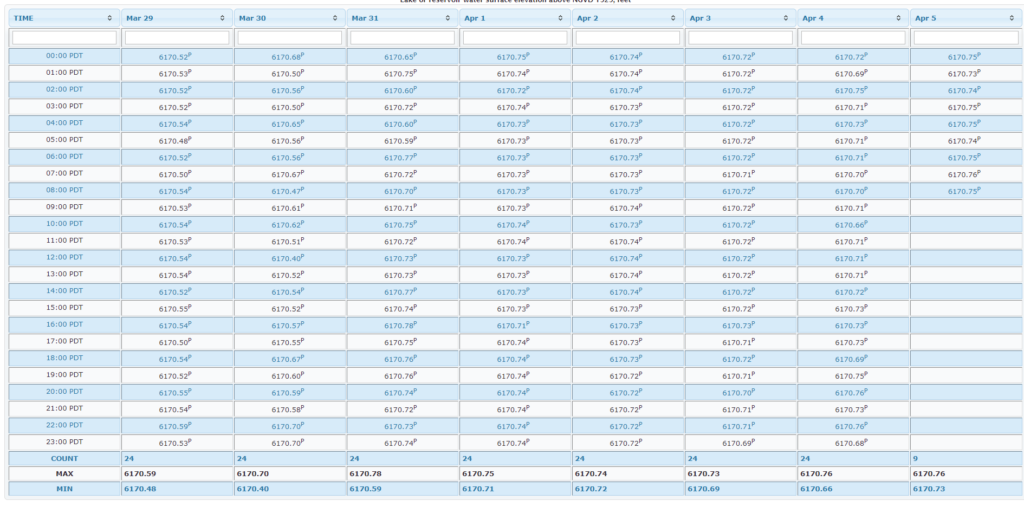
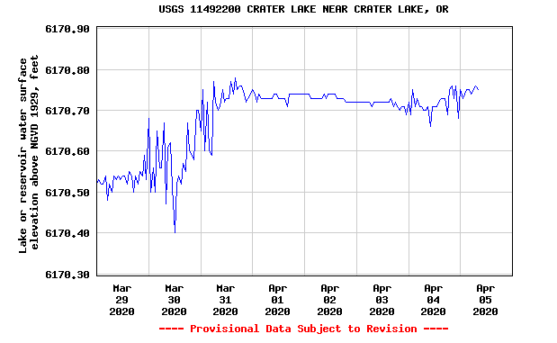
The United States Geologic Survey has a water level monitor on the lake near Cleatwood dock. It’s unmaintained in winter, but shows current and past water levels – a great resource.
Click below for current water levels. This takes you out of our website, so please come back soon.
https://waterdata.usgs.gov/or/nwis/uv/?site_no=11492200&agency_cd=USGS
Other pages in this section