
Crater Lake National Park and the National Park Service
Crater Lake National Park is located along the crest of the Cascade Mountain Range, approximately 70 miles northeast of Medford, Oregon (Figure 1). Formed after the volcanic eruption of Mount Mazama approximately 7,700 years ago, Crater Lake, at 1,932 feet, is the deepest lake in the United States and the seventh deepest lake in the world. Crater Lake National Park encompasses approximately 188,000 acres and was established in 1902 as America’s sixth national park.
The National Park Service
Since its inception on August 25, 1916, the NPS has managed and regulated national parks, national monuments, and other management units within the national park system for the purpose of protecting and conserving the natural, cultural, and historic resources contained within unit boundaries. However, just as it is the responsibility of the NPS to protect and conserve these resources, the NPS must also impart the significance of these resources and their contributions to the nation and the public.
Park boundaries
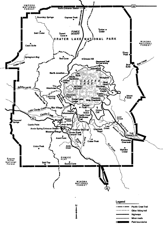
Figure 1. Regional Map and Location of Study Areas.
The intent of the planning process ongoing in Crater Lake National Park is to define a balance between resource protection and visitor use. The challenge is to emphasize the park’s uniqueness; the guiding principle is to do nothing that will impact the qualities of park resources.
Why Develop a Winter Use Plan?
Why plan? The WUP is being prepared to better clarify the types and levels of appropriate winter recreational uses. The plan is being prepared to supplement information provided in response to the House-Senate Appropriations 1992 Conference Agreement requesting an evaluation of appropriate winter uses and the locations where these activities would occur. The WUP will address the following:
-
purpose and need for the WUP,
-
existing winter recreational activities,
-
existing winter demand for services and facilities,
-
winter activities appropriate for the park,
-
winter use alternative scenarios,
-
a preferred alternative,
-
costs to provide additional services, and
-
environmental assessment of each winter use scenario.
The WUP will augment existing planning documents by defining the winter recreational use scenario most appropriate for Crater Lake National Park, and it will provide the NPS a tool for guiding winter use in the park. The WUP will be incorporated into the Development Concept Plan now being prepared for Munson Valley, Mazama Village, and the south entrance area of the park. The environmental assessment will be prepared in compliance with the National Environmental Policy Act. Winter recreational uses in the park will not change until the plan has been completed.