
Geological History of Crater Lake
As the boat skirts the western shore and passes toward Llao Rock the layered structure of the rim is evident, although it is fairly well illustrated on all sides. On the whole the lava streams predominate, although there is much conglomerate.
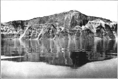
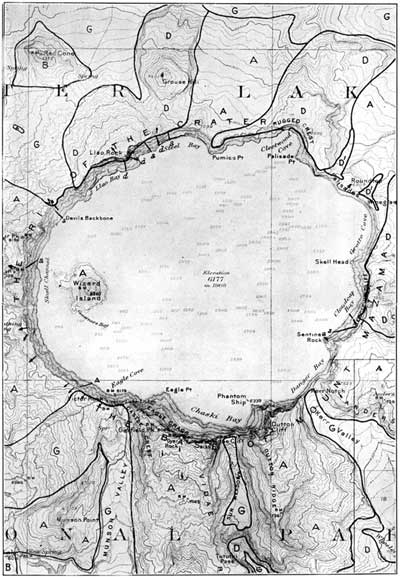
Of all the flows exposed upon the inner slope that of Llao Rock is most prominent and interesting. In the middle it is over 1,200 feet thick, and fills an ancient valley down the outer slope of the rim. (See fig. 15.) Upon either side it tapers to a thin edge against the upper slope of the valley. To the lake it presents a sheer cliff—that is, it is abruptly cut off—and one wonders how much farther it may have extended in that direction. Beneath the rock the outline of the valley in cross section is evident. It rests upon pumice and many layers of older lavas, forming the rim down to the water’s edge. The direction of flow in this great lava stream forces us to believe that it was erupted from a large volcano which once stood upon the site of the lake. Every layer of lava in the rim is a coulee, dipping away from the lake. This is especially well shown in the canyon of Sun Creek (see fig. 12), cut in its outer slope. The sections of these radiating flows exposed upon the inner slope of the rim all tell the same story as to their source. By projecting the lavas in their course toward a common center we can reconstruct in fancy the great volcano, Mount Mazama, which once occupied the place of the lake, and, like Shasta or Rainier, formed a great landmark of the region.