Geological History of Crater Lake
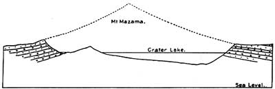
In figure 22 is given a section of Crater Lake and its rim, with the probable outline of Mount Mazama, and in figure 23 is given a profile and surface sketch of a cross section of the natural park through Crater Lake.
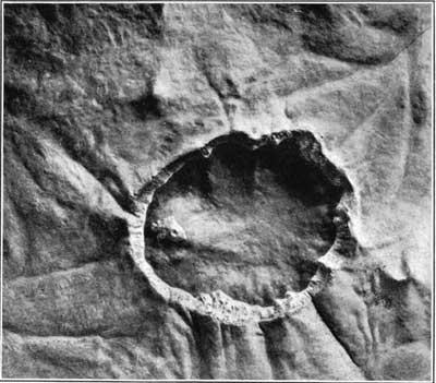
Wonderful as the lake, encircled by cliffs, may be, it serves but to conceal in part the greatest wonder—that is, the enormous pit or caldera which is half filled by the lake. The caldera is 4,000 feet deep. An impressive illustration of it is seen in figure 21 which was prepared from a photograph of a model of Crater Lake now in the United States National Museum. The water surface is represented by glass, so that one may see through to the bottom and get the full impression of the depth of this tremendous hole in the ground. It extends from the top of the rim, which is the very summit of the Cascade Range, halfway down to the sea level, and nearly a square mile of its bottom is below the level of Upper Klamath Lake at the eastern foot of the range. The volume of the caldera is nearly a dozen cubic miles, and if we add the volume of the lost Mount Mazama that amount would be increased by at least one-half. How was it possible to remove so large a mass and in process develop so great a depression?