
Geological History of Crater Lake
The journey from Ashland by the Dead Indian road crosses the range where the average altitude is less than 5,000 feet. The road passes within a few miles of Mount McLoughlin and skirts Pelican Bay of Klamath Lake, famous for its fishing. After following northward for some 20 miles along the eastern foot of the range, it ascends the eastern slope, along the castled canyon of Anna Creek to the rim of Crater Lake.
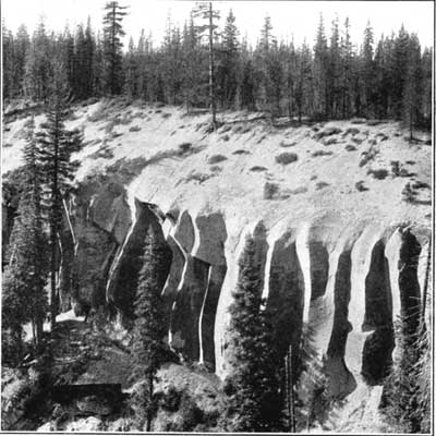
From Medford or Gold Hill the trip is a trifle shorter by the Rogue River road. It affords some fine views of the canyons and rapids of that turbulent stream and of the high falls, where it receives its affluents. Striking features along both roads, within 20 miles of the lake, are the plains developed upon a great mass of detritus filling the valleys. Across these plains Anna Creek and Rogue River have carved deep, narrow canyons with finely sculptured walls (fig. 4), which the roads follow for some distance.
With the completion of the railroad on the east the approach to the lake was greatly facilitated. Leaving the railroad near Klamath Falls, a small steamer crosses Upper Klamath Lake and connects with automobile stages to the lake.