
The Geology of Crater Lake National Park, Oregon With a reconnaissance of the Cascade Range southward to Mount Shasta by Howell Williams
The Foundations of Mount Mazama
The Union Peak Volcano
Limits of the Volcano
It is impossible to tell how far the Union Peak lavas spread, for toward the north and east they pass beneath Mount Mazama and in other directions they merge into identical lavas from other sources. Certainly the shield is at least 8 to 9 miles in diameter and more than 3000 feet high.
Immediately to the west of Union Peak, beyond the confines of the park, lies Huckleberry Mountain. Here are more than 60 square miles of westward-dipping lavas similar to those of Union Peak. On the mountain itself there is no indication of a vent, and it may be, therefore, that the Huckleberry lavas escaped from fissures at the base of the Union Peak volcano. But it would require further study to disprove or verify the alternative view that they are part of an older volcano whose eastern part has been downfaulted and buried beneath the products of Union Peak.
Southward, the Union Peak lavas interfinger with similar flows erupted from vents the positions of which are not precisely known. In fact, from Union Peak southward as far as Mount Shasta, approximately 80 miles away, the deeply scarred plateau of the High Cascades contains almost no other lavas than olivine basalts and olivine-bearing basaltic andesites like those of Union Peak.
It would be interesting to know whether or not the lavas of Union Peak extend beneath the waters of Crater Lake, but there is no conclusive evidence bearing on the point. Certainly they do not appear on the caldera walls, though they approach to within 2 1/2 miles at the head of Castle Creek, and if their dip at that place were projected northward they would occur at a level of approximately 5000 feet in the center of the caldera. If Union Peak lavas once extended this far, one might expect to find fragments of them among the explosive ejecta of Mount Mazama, but neither in the pyroclastic materials of the caldera walls nor in the pumice blown out during the final eruptions have any such fragments been recognized.
|
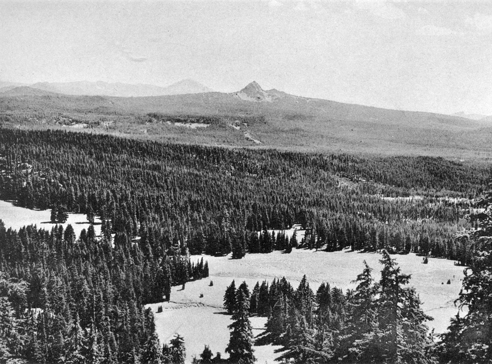
Plate 4. Fig. 1. The Union Peak volcano, looking south from the Rim Road near the Watchman. The long, gentle slopes of the volcano are of lava; the summit pinnacle represents the filling of the central conduit. Between the gentle lava slopes and the central plug, and largely concealed by talus, are the eroded remnants of a tuff cone that formerly occupied the crater. Mount McLoughlin, another High Cascade cone, shows faintly in the distance. The foreground is part of Mount Mazama. |
***previous*** — ***next***