
The Geology of Crater Lake National Park, Oregon With a reconnaissance of the Cascade Range southward to Mount Shasta by Howell Williams
The Climax: Culminating Explosions of Pumice and Scoria
The Glowing Avalanches: Pumice and Scoria Flows
Distribution
The outstanding feature of the distribution of the pumice flows is the manner in which they follow the principal canyons around Crater Lake (see map, figure 16). Clearly the explosions were not “directed” from the summit of the volcano as downward blasts, but their course was determined largely by the topography.
|
Fig. 16. Map showing distribution and thickness of Crater Lake pumice. (Drawn by A. W. Severy.) |
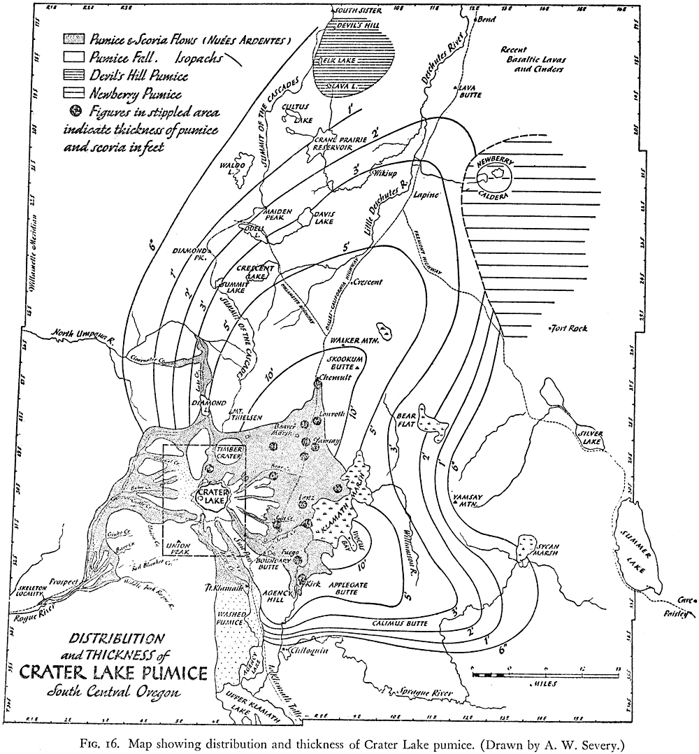
On the southwest and west sides of the volcano, the flows did not begin to drop their heavy load until they had traveled about 5 or 6 miles from the source, for the slopes between the caldera rim and the headwaters of Castle, Copeland, and Bybee creeks are covered with only a thin and patchy veneer of pumice. Once the flows entered the canyons of those creeks, however, the pumice accumulated to depths of as much as 200 feet. This singular scarcity of pumice on the southwest and west flanks of the cone is only in minor part the result of erosion. The main causes were probably two: first, these bare slopes were then blanketed with snow, and, second, the flows rushed across them too swiftly to permit deposition. When their speed was checked on entering the U-shaped glacial canyons, the flows began at once to drop their detritus, and in that manner the valleys were choked and converted into the wide plains of pumice we see today.
Within the canyons, the margins of the pumice flows are usually sharp enough to be located within a few tens of yards, but where the flows were not confined by steep valley walls they spread to a feather edge, and it is difficult to see where they end against the underlying pumice fall.