
Classification of the Soils
Grousehill Series
Depth class: Moderately deep to a duripan (fig. 10)
Drainage class: Moderately well drained
Permeability: Moderate
Position on landscape: Ridges and benches
Parent material: Ash over glacial till
Slope range: 0 to 35 percent
Elevation: 4,500 to 7,000 feet
Average annual precipitation: 45 to 70 inches
Average annual air temperature: 38 to 42 degrees F
Frost-free period: 10 to 35 days
Taxonomic class: Medial-skeletal, amorphic Typic Duricryands
Typical Pedon
Oi—0 to 3 inches; slightly decomposed needle litter; abrupt wavy boundary.
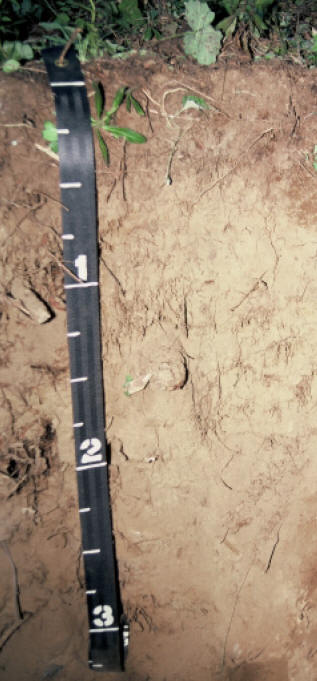
Figure 10.—Typical profile of a Grousehill soil. Measurements on tape are in feet.
A—3 to 10 inches; dark brown (7.5YR 3/3) gravelly medial loam, yellowish brown (10YR 5/4) dry; weak fine granular structure; soft, very friable, nonsticky and slightly plastic; many very fine, fine, and medium roots and common coarse roots; many very fine interstitial pores; 10 percent rounded andesite gravel, 5 percent rounded andesite cobbles, and 5 percent pumice paragravel; slightly acid (pH 6.4); clear wavy boundary.
Bw1—10 to 31 inches; dark brown (7.5YR 3/4) very cobbly medial loam, brown (7.5YR 5/4) dry; weak very fine subangular blocky structure; soft, very friable, nonsticky and slightly plastic; many fine and medium roots and common coarse roots; many very fine interstitial pores; 10 percent andesite gravel, 30 percent rounded andesite cobbles, 15 percent rounded andesite stones, and 15 percent pumice paragravel; slightly acid (pH 6.4); clear wavy boundary.
Bw2—31 to 39 inches; very dark grayish brown (10YR 3/2) very cobbly medial loam, yellowish brown (10YR 5/4) dry; weak very fine subangular blocky structure; slightly hard, friable, slightly sticky and slightly plastic; common medium roots and few fine and coarse roots; many very fine interstitial pores; 10 percent andesite gravel and 30 percent rounded andesite cobbles; slightly acid (pH 6.2); abrupt wavy boundary.
Bqm—39 to 56 inches; dark gray (10YR 4/1) moderately cemented duripan, light gray (10YR 7/1) dry; massive; extremely hard, slightly rigid.
Typical Pedon Location
Map unit in which located: Grousehill gravelly medial loam, 0 to 25 percent slopes
Location in park: About 2.5 miles north of State Highway 62 and 1/4 mile east of park boundary; 558994 meters easting and 4753267 meters northing, UTM Zone 10T, NAD 27
Range in Characteristics
Profile:
Depth to moderately cemented duripan—20 to 40 inches
Shape of rock fragments—round
Content of clay—15 to 25 percent
Depth to perched water table—28 to 38 inches in November through July
A horizon:
Hue—10YR or 7.5YR
Value—2 to 4 moist, 4 to 6 dry
Chroma—2 to 4 moist or dry
Content of rock fragments—10 to 35 percent
Content of pumice paragravel—0 to 15 percent
Bw horizon:
Hue—10YR or 7.5YR
Value—3 or 4 moist, 4 to 6 dry
Chroma—3 or 4 moist or dry
Texture—medial loam or medial sandy loam
Content of rock fragments—35 to 70 percent
Content of pumice paragravel—0 to 20 percent
Bqm horizon:
Hue—10YR or 7.5YR
Value—3 or 4 moist, 4 to 7 dry
Chroma—1 to 4 moist or dry
Content of rock fragments—35 to 60 percent
Grousehill Taxadjunct
Depth class: Deep to a duripan
Drainage class: Moderately well drained
Permeability: Moderate
Position on landscape: Drainageways on mountains
Parent material: Ash over glacial till
Slope range: 0 to 5 percent
Elevation: 4,000 to 5,500 feet
Average annual precipitation: 50 to 70 inches
Average annual air temperature: 40 to 42 degrees F
Frost-free period: 10 to 50 days
Taxonomic class: Medial-skeletal, amorphic Aquic Haplocryands
Typical Pedon
A1—0 to 2 inches; very dark brown (10YR 2/2) ashy loamy sand, dark brown (10YR 3/3) dry; moderate very fine granular structure; soft, very friable, nonsticky and nonplastic; many very fine roots; many very fine interstitial pores; moderately acid (pH 6.0); clear smooth boundary.
A2—2 to 12 inches; very dark brown (10YR 2/2) ashy sandy loam, yellowish brown (10YR 5/4) dry; moderate fine subangular blocky structure; soft, very friable, nonsticky and nonplastic; many very fine and fine roots and common medium roots; many very fine interstitial pores; 5 percent andesite gravel; moderately acid (pH 6.0); clear smooth boundary.
2Bw1—12 to 30 inches; dark grayish brown (10YR 4/2) very gravelly medial loam, light brownish gray (10YR 6/2) dry; weak fine subangular blocky structure; slightly hard, friable, slightly sticky and slightly plastic; many very fine and fine roots; common fine dendritic tubular pores; 20 percent andesite gravel and 15 percent rounded andesite cobbles; moderately acid (pH 6.0); clear smooth boundary.
2Bw2—30 to 36 inches; brown (10YR 4/3) very gravelly medial clay loam, pale brown (10YR 6/3) dry; moderate medium subangular blocky structure; hard, friable, slightly sticky and slightly plastic; many fine roots; few fine dendritic tubular pores; 20 percent andesite gravel, 15 percent rounded andesite cobbles, and 5 percent rounded andesite stones; few faint medium brown (10YR 5/3) iron depletions and common very fine distinct strong brown (7.5YR 4/6) iron concentrations; moderately acid (pH 6.0); clear irregular boundary.
2BC—36 to 45 inches; brown (10YR 4/3) very gravelly medial sandy clay loam, pale brown (10YR 6/3) dry; moderate medium subangular blocky structure; hard, friable, slightly sticky and slightly plastic; many fine roots; few fine dendritic tubular pores; 30 percent andesite gravel, 10 percent rounded andesite cobbles, and 5 percent rounded andesite stones; few faint medium brown (10YR 5/3) iron depletions and common very fine distinct strong brown (7.5YR 4/6) iron concentrations; moderately acid (pH 6.0); clear irregular boundary.
2Bqm—45 to 60 inches; brown (10YR 4/3) moderately cemented duripan, light brownish gray (10YR 6/2) dry; massive; very hard, slightly rigid; 35 percent andesite gravel, 15 percent rounded andesite cobbles, and 10 percent rounded andesite stones.
Typical Pedon Location
Map unit in which located: Grousehill-Racing complex, 0 to 5 percent slopes
Location in park: About 1/4 mile east and 21/2 miles north of State Highway 62, along the western boundary in “Poison Meadows”; 558656 meters easting and 4752907 meters northing, UTM Zone 10T, NAD 27
Range in Characteristics
Profile:
Depth to moderately cemented duripan—40 to 60 inches
Depth to bedrock—more than 60 inches
Depth to redoximorphic features—20 to 30 inches
Content of clay—10 to 28 percent
Average content of rock fragments in control section—more than 35 percent
A horizon:
Hue—10YR or 7.5YR
Value—2 to 4 moist, 3 to 6 dry
Chroma—2 or 3 moist or dry
Content of gravel—0 to 15 percent
Content of cobbles—0 to 10 percent
2Bw and 2BC horizons:
Hue—10YR or 7.5YR
Value—3 or 4 moist, 6 or 7 dry
Chroma—2 to 4 moist or dry
Content of rock fragments—35 to 70 percent
Content of gravel—15 to 50 percent
Content of cobbles—0 to 25 percent
Content of stones—0 to 15 percent
2Bqm horizon:
Hue—10YR or 7.5YR
Value—3 or 4 moist, 4 to 7 dry
Chroma—1 to 4 moist or dry
Content of gravel—15 to 50 percent
Content of cobbles—0 to 25 percent
Content of stones—0 to 15 percent
Taxadjunct Features
The Grousehill soil in areas of Grousehill-Racing complex, 0 to 5 percent slopes, is a taxadjunct to the Grousehill series because the duripan is at a depth of 40 to 60 inches and redoximorphic features are in the upper 1 meter.
***previous*** — ***next***