
Klamath Network Water Quality Report (Phase II)
Introduction
The Klamath Network (KLMN) Water Quality Report is intended to provide a broad overview of aquatic resources at the network and park unit levels. Figure 1 is an example of one type of aquatic resource present in Klamath Network park units, and is representative of inland montane lakes within the network. The report begins with an overview of aquatic resources of the Klamath Network and includes identification of the locations of active monitoring stations in or near park units where various parameters (e.g., precipitation, evaporation, temperature, general water quality) are measured. This overview is followed by a general discussion of past and present water quality inventory, monitoring, and research activities in each park unit, a list of references associated with these activities, and a review of common (i.e., network-wide) water quality inventory, monitoring, and research themes related to these activities. Past and present monitoring and research programs of allied agencies in the KLMN region are then discussed followed by a detailed review of the Klamath Network Vital Signs Scoping Process and park-specific/network-level outcomes. The final section of the report presents park specific responses to the Aquatic Resources and Water Quality Questionnaire solicited from each park unit.
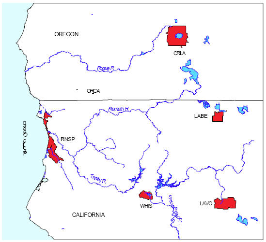 |
| FIGURE 2: Klamath Network park units: Crater Lake National Park (CRLA), Lassen Volcanic National Park (LAVO), (Lava Beds National Monument (LABE), Oregon Caves National Monument (ORCA), Redwood National and State Parks (RNSP), and Whiskeytown National Recreation Area (WHIS). LAVO, LABE, and ORCA are the park units that have been selected for the current baseline inventory. |
***previous*** — ***next***