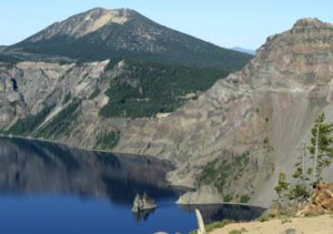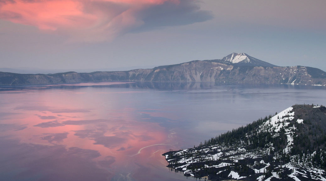

Anderson Bluffs Trail – Crater Lake National Park
REI Trails Project partners with Crater Lake Institute to produce their trails app. Click the map below, get the app – then come back, we offer more. Trail Description
This trail moves west to east through the Kerr Valley at the base of Anderson Bluffs. It has not been maintained regularly and can be difficult to follow. The trail moves up and down a bit, but, there are no major elevational changes, making for a moderate hike. The forest cover is primarily of mountain hemlock and shasta red fir. Trailhead location: The trailhead is located at a small turnout 1.3 miles south on the Pinnacles Valley road, from it’s intersection with the East Rim Drive (near the Phantom Ship Overlook). Look to the north side of the road for the turnout. Nature Note: Glaciers carved the valley which this trail passes through and lava flows filled it in and were then eroded to their present state by stream action. You can also find large and impressive moraines along the trail. These are in the form of lateral moraines. Lateral moraines form along the edges of glaciers. Material from the valley walls is broken up by frost shattering and falls onto the ice surface. It is then carried along the sides of the glacier. When the ice melts it forms a ridge of material along the valley side. Seasonal Information: Expect the trail to be covered in snow from October to early July, however, conditions vary somewhat from year to year. See Crater Lake historic Weather Conditions for more information.
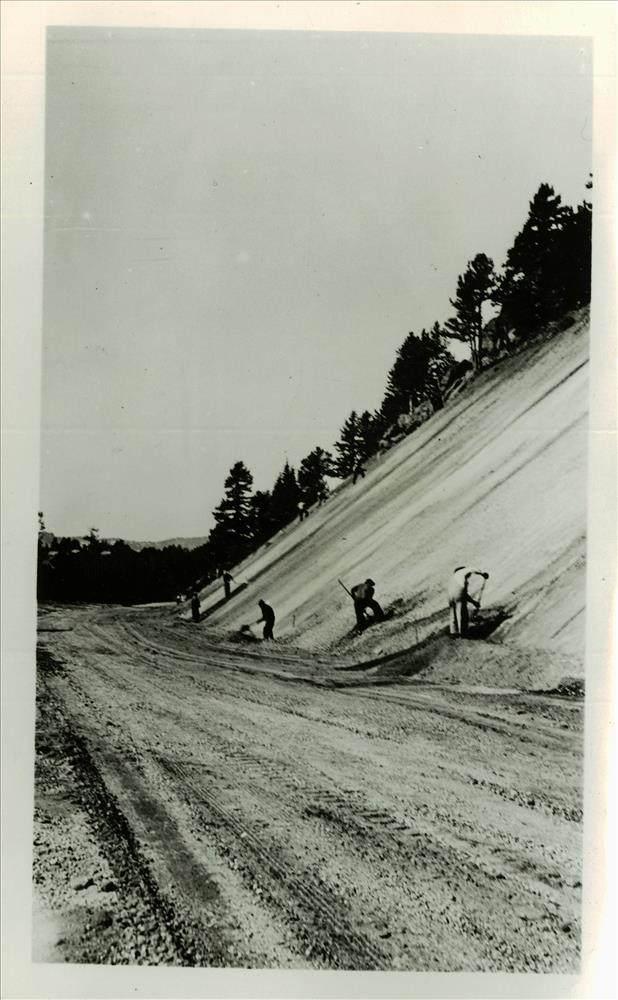
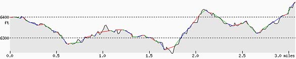
Anderson Bluffs in Crater Lake NP, circa 1938 F. G. Lange Anderson Bluffs Trail Elevation Profile
Note: this profile does not include the portion of the trail that moves south.
Related Maps Digital USGS topographic maps (PDF files) – the following maps are relevant to the Anderson Bluffs trail. See more Crater Lake Institute online USGS digital maps.
|