
In the matter of photographs, I wish to thank Messrs. Elmer Aldrich, William Schoeb, Victor Duran, and H. B. Taylor, the United States Army Air Corps, the Washington National Guard, and the National Park Service. The beautiful paintings reproduced as plate 18, figures 1 and 2, and plate 22, figure 2 were made under my direction by Mr. Paul Rockwood, of the National Park Laboratories, Western Division, at Emeryville, California. Mr. A. W. Severy, of the same laboratories, prepared certain of the maps; Dr. Henry P. Hansen made pollen analyses of peat samples from Munson Valley; Mr. W. H. Kirkbride, chief engineer of the Southern Pacific Company, placed at my disposal logs of wells drilled through the pumice deposits east of Crater Lake; my colleague Professor C. A. Anderson assisted by much profitable discussion; and, finally, the Board of Research of the University of California granted additional financial aid for transportation and chemical analyses.
|
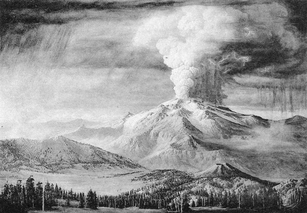
Plate 18. Fig. 1. Mount Mazama immediately before the collapse of the summit, looking north from near Union Peak. From a painting by Paul Rockwood. Shows the general configuration of the volcano when the culminating eruptions began. Wind blowing to the northeast, carrying granular pumice. Typical cauliflower eruption clouds such as must have formed during the opening activity. The three glaciers on the south slope of the volcano are, from left to right, the Munson, Sun, and Kerry Valley glaciers. Below them stretch bare, U-shaped glacial canyons. The small cone near the center of the picture is the parasitic Crater Peak. Pumice Flat in left foreground. |
|
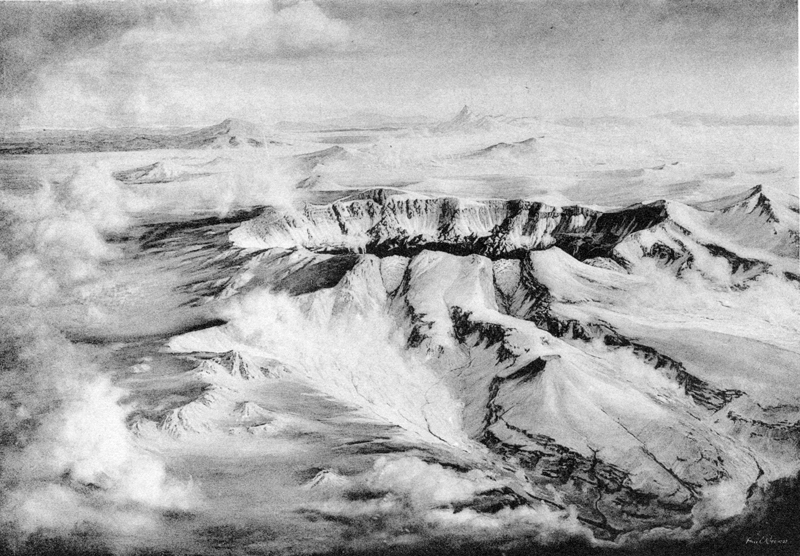
Plate 18. Fig. 2. Mount Mazama immediately after the collapse of the summit. From a painting by Paul Rockwood. Compare figure 1, above. Note that the U-shaped glacial canyons have been filled with the deposits of glowing avalanches (nuées ardentes), from which countless fumaroles give off gas. The plains beyond the caldera are also covered with pumice-scoria flows which discharge fumaroles. Note that pumice is almost absent on the west (left) slope of the volcano and thickens toward the east. The beheaded glaciers of Munson, Sun, and Kerr valleys are shown. The caldera floor lies approximately 2000 to 4000 feet below the rim. |
|
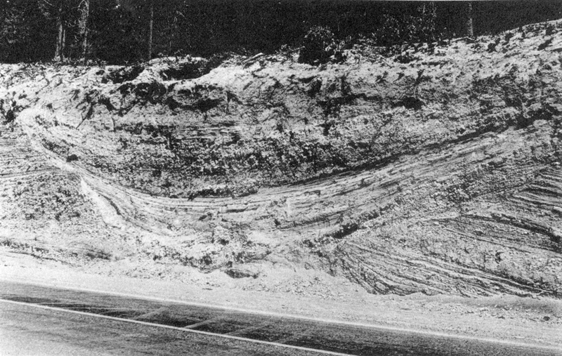
Plate 22. Fig. 1. Typical glacial striae on the caldera rim near Discovery Point. The overlying deposits are of pumice charged with lithic fragments. (Photograph by George Grant, National Park Service.) |
***previous*** — ***next***