
The Geology of Crater Lake National Park, Oregon With a reconnaissance of the Cascade Range southward to Mount Shasta by Howell Williams
The Formation of Mount Mazama Just before Its Destruction
THE remnant slopes of Mount Mazama show the concave profile typical of composite volcanoes, and it may be assumed with confidence that the missing slopes were steeper than those which remain. Unfortunately nothing is known of the manner in which the missing part was constructed, so that there is no means of determining just how steep they were. Nor is there any evidence to indicate the size of the former summit crater. Accordingly, estimates of the original height of the volcano can only be approximate. Nevertheless, in order to reach a conclusion as to how Crater Lake was formed, it is essential to determine as closely as possible how much of Mount Mazama has disappeared.
|
Fig. 13. Profiles through Mounts Shasta, Rainier, and Adams, and Crater Lake. |
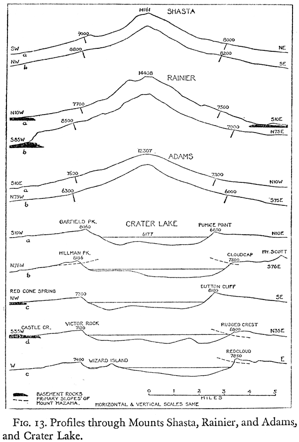
Conclusive proof of the former existence of a high cone is the fact that large glaciers, one of them at least 17 miles long, once swept down the sides of Mount Mazama. Glaciers of such size, even during the Pleistocene period, must have originated on a cone far higher than the present rim of Crater Lake. This much follows from a study of the size of Pleistocene glaciers on neighboring Cascade volcanoes.
We are aided in forming an estimate of the original size of the cone by comparing its remnant profiles with those of other Cascade volcanoes formed of similar materials, and we are assisted further by picturing the formation on these volcanoes of calderas of the same size as Crater Lake and noting the elevations of their imaginary rims (see figures 13 and 14).