| The following diagrams show the formation of Crater Lake during the climactic eruption of Mount Mazama. Diagrams are by Charles Bacon, acquired from the 1988 edition of the 1:62,500 scale topographic map entitled “Crater Lake National Park and Vicinity, Oregon.” |
|

|
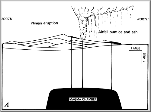
| Figure A: Plinian eruption deposits airfall pumice and ash, blown by winds to north and east. |
|
|
|
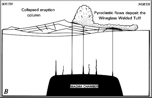
| Figure B: Vent enlarges and eruption column collapses; pyroclastic flows deposit the Wineglass Welded Tuff on north and east flanks. |
|
|
|
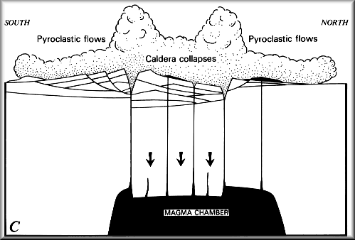
| Figure C: Roof of magma chamber collapses, forming caldera as new vents open above fractures; pyroclastic flows deposit pumice and ash on all flanks of Mount Mazama and in valleys below. |
|
|
|
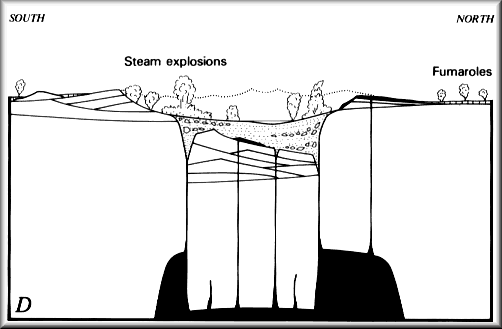
| Figure D: Caldera has been partly filled with pumice and ash from the eruption shown in C and with blocks of rock from the caldera walls; weak, dying explosions within the caldera deposit ash on the caldera rim; pyroclastic-flow deposits develop fumaroles and gradually cool. |
|
|
|
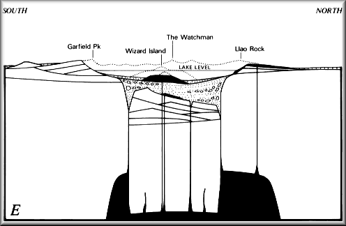
| Figure E: Crater Lake today. |