
Mount Mazama’s Final Eruption
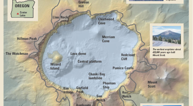
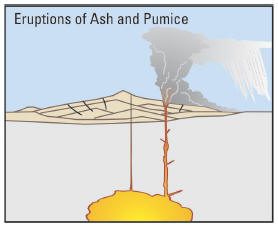
The cataclysmic eruption of Mount Mazama 7,700 years ago started from a single vent on the northeast side of the volcano as a towering column of pumice and ash that reached some 30 miles (50 km) high. Winds carried the ash across much of the Pacific Northwest and parts of southern Canada. So much magma erupted that the volcano began to collapse in on itself. As the summit collapsed, circular cracks opened up around the peak. More magma erupted through these cracks to race down the slopes as pyroclastic flows. Deposits from these flows partially filled the valleys around Mount Mazama with up to 300 feet (100 m) of pumice and ash. As more magma was erupted, the collapse progressed until the dust settled to reveal a volcanic depression, called a caldera, 5 miles (8 km) in diameter and one mile (1.6 km) deep.
|
|
|
|
|
|
|
|
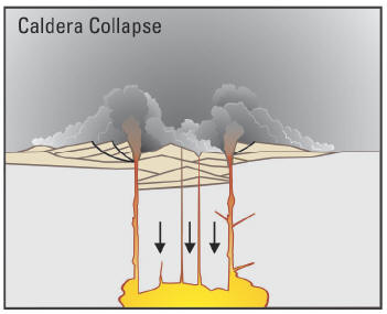
| Cataclysmic eruption to present. Eruptions of ash and pumice: The cataclysmic eruption started from a vent on the northeast side of the volcano as a towering column of ash, with pyroclastic flows spreading to the northeast. Caldera collapse: As more magma was erupted, cracks opened up around the summit, which began to collapse. Fountains of pumice and ash surrounded the collapsing summit, and pyroclastic flows raced down all sides of the volcano. Steam explosions: When the dust had settled, the new caldera was 5 miles(8km) indiameterand1mile (1.6km) deep. Ground water interacted with hot deposits causing explosions of steam and ash. Today: In the first few hundred years after the cataclysmic eruption, renewed eruptions built Wizard Island, Merriam Cone, and the central platform. Water filled the new caldera to form the deepest lake in the United States. Figure modified from diagrams on back of 1988 USGS map “Crater Lake National Park and Vicinity, Oregon.” |
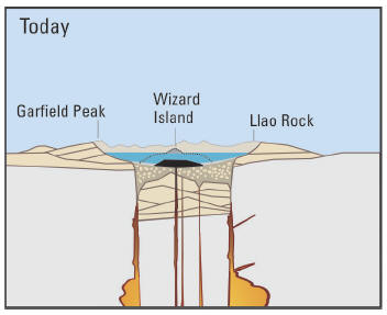
Soon after the cataclysmic eruption, eruptions from new vents within the caldera built the base of Wizard Island and the central platform. As eruptions continued, rain and snowmelt also began to fill the caldera. For the next few hundred years, eruptions from these new vents kept pace above the rising water level. Lava flowed into the deepening lake, creating benches on the flanks of the growing cones that tell scientists how deep the lake was during these eruptions. One set of eruptions from a crater on the west edge of the central platform formed lava tubes or channels that sent lava far out onto the caldera floor.
Later eruptions from a vent in the northern part of the caldera, just south of present-day Cleetwood Cove, built Merriam Cone. The erupting Merriam Cone probably never reached the lake surface. The ever-deepening lake eventually drowned the central platform volcano as well. Only Wizard Island managed to grow high enough to stay above the waterline. The last eruptions at Wizard Island took place when the lake was about 260 feet (80 m) lower than today. All of this activity occurred within 750 years after the cataclysmic eruption. The water level continued to rise until reaching near present-day levels, where it encountered a thick layer of porous deposits in the northeast caldera wall. These deposits stabilize lake levels like an overflow drain in a bathtub.
Sometime after these eruptions, the Chaski Bay landslide, the top of which is still visible above the southern shore of Crater Lake, slumped into the caldera and ran up onto the edge of the central platform. Other landslides within the caldera were deflected by the base of Wizard Island and the central platform, burying explosion craters and other features on the lake floor with even more debris.
The last known eruption at Crater Lake occurred when a small lava dome erupted under water on the east flank of the base of Wizard Island about 4,800 years ago. Since that time, the volcano has remained quiet, allowing as much as 100 feet (30 m) of sediment to accumulate on the lake bottom.