
Water balance for Crater Lake, Oregon by Manuel Nathenson
Figures
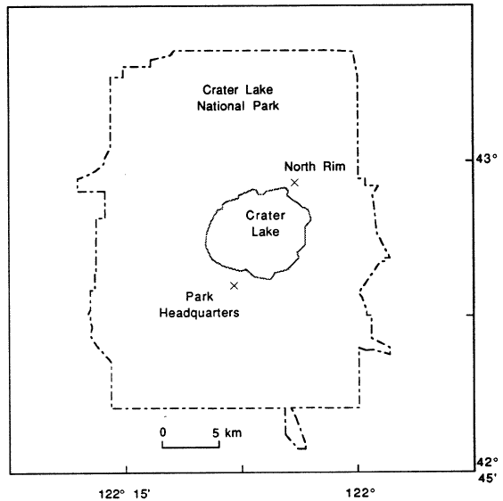 |
| Figure 1. Map of Crater Lake National Park showing locations of precipitation gages at Park Headquarters and at the North Rim. |
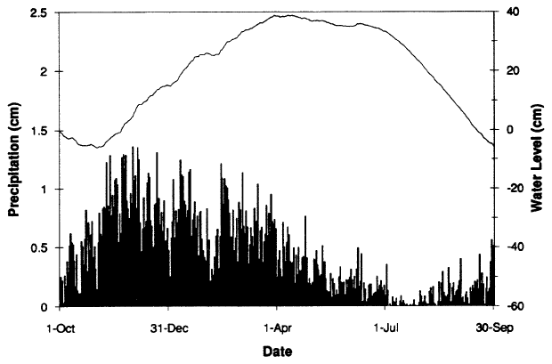 |
| Figure 2. Water level for Crater Lake and daily precipitation at Park Headquarters averaged over years with complete records (Water years 1962-64, 1966-72, 1975-77, 1979-85, 1988-89). Water-level data from U.S. Geological Survey (1970, 1976, 1972 – 1979, 1981a & b, 1983), Alexander and others (1987, 1988, 1989), Hubbard and others (1983, 1984, 1986, 1989, 1990). Precipitation data from National Oceanic and Atmospheric Administration (1961-89). |
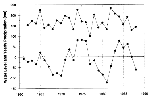 |
| Figure 3. Water level for Crater Lake (above 1882.14 m elevation) and yearly precipitation at Park Headquarters. Water year is Oct 1 to Sep 30. |