
 |
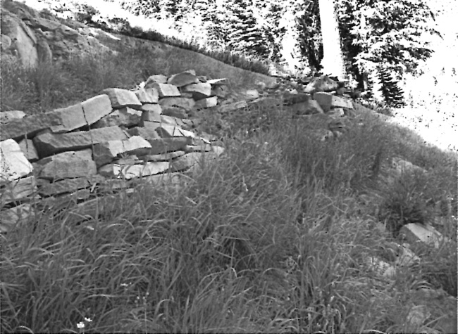
| Benching on a section of the abandoned Vidae Falls Trail, 2010. Photo by the author. |
Temporary employees hired by the PWA also contributed to trail improvements beginning in 1933. By early fall of that year, $450 had been spent to make the Crater Peak Trail some 4,000 feet long, 30 inches wide, and provide a maximum grade of 15 percent. At the same time, double that amount of PWA funds went toward improving the Union Peak Trail. It had the same length and maximum gradient, but a full three feet of width upon completion in October.105 A PWA crew also undertook building yet another trail on Wizard Island the following year, this one utilizing three switchbacks on the south side of the cinder cone.106 Finished by September 1934, the trail extended 5,500 feet from the boat landing on Governors Bay to the summit crater. The project also provided a connection with a shoreline trail to Fumerole Bay, one pioneered by Ansel Hall in 1931. This project came amid debate over whether Hall’s “spiral return trail” should be retained as part of ranger-led trips on the island since it circled the cone and allowed visitors to note differences in vegetation based on their aspect.107
Trail maintenance became a CCC responsibility at Crater Lake during the New Deal, though this activity did not take place on an annual basis except for work to open the Crater Wall Trail, a task usually involving considerable snow removal. Unusually heavy thunderstorms in July 1935 also carried thousands of yards of material over the trail, requiring much additional work by CCC crews.108The other project for the summer of 1935 involved a group of enrollees maintaining and repairing 18 miles of horse trails in the park. This figure included the 13.5 miles of bridle paths built by NPS crews in 1930-31, but presumably other trails (such as the one to Mount Scott) receiving more use.
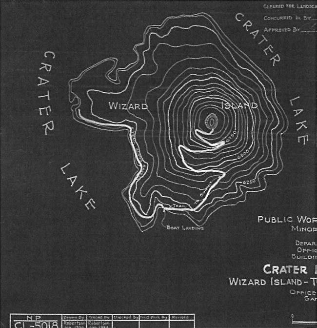 |
| Public Works Administration map of the Wizard Island Trail project, 1934, author’s files. |
The CCC did not construct any new trails at Crater Lake that summer, though several proposals had been floated by the NPS. One project had been initially programmed, that of building a one mile trail to the top of Red Cone from the motorway below it, but this prospect fizzled in the face of other priorities.109 The NPS regional geologist visited Crater Lake that summer and suggested that the CCC construct trails to several points of geological interest.110 One of these proposals persisted on the main park planning document (a master plan) for more than a decade and consisted of a trail some two feet wide leading from the North Junction to Llao Rock. The project remained a low priority, however, and was never undertaken.111