
The Impact of Climate on the Physics, Hydrology, and Biogeochemistry of Crater Lake, Oregon, July 1999 – June 2004

Primary Contact: Gary Larson, USGS
Forest and Rangeland Ecosystem Science Center
Large, deep lakes offer a unique resource for studying the interaction of the atmosphere, land surface hydrology, and aquatic ecosystems. heir large volume integrates the complexities of short-term variability in local climate. Thus, large lakes provide relatively manageable systems to both monitor and interpret the effects of global climate change on land surface processes. Crater Lake offers a pristine and relatively simple system to detect these changes through long-term study. It also provides a powerful natural laboratory to study the processes that link climate physics to the operation of biogeochemical cycles in aquatic ecosystems.
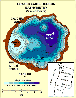
Crater Lake, the deepest lake in the United States (590 m), is a closed-basin caldera lake formed after the explosive eruption of Mt. Mazama, 6950 years ago. It is the center piece of Crater Lake National Park and located at an elevation of 1882 meters in the Cascade mountains of south-central Oregon.
The steep caldera walls surrounding the lake result in a very small watershed such that external flows of nutrients to the lake are low and dominated by precipitation and dry deposition from the atmosphere. These conditions contribute to the lake’s low nutrient levels and exceptional clarity. There are no major inlet streams and no surface outlet.
The surface elevation of Crater Lake responds quickly to climate and weather fluctuations because the closed caldera functions as a giant rain gage. Annual fluctuations in elevation average about 0.5 m, but long-term declines and recoveries in lake level have been recorded since the late 1800’s. The maximum drop (4 m) coincided with the “Dust Bowl” in the Midwest during the 1930’s. Recent climate variations have resulted in highs and lows that nearly match the historical extremes.
Changes in climate also affect lake temperatures and water circulation patterns. In spite of its great depth, the lake mixes rapidly — over a timescale of 3-5 years — and recycled nitrogen carried upwards from the deep lake represents the largest annual source of this limiting nutrient.
This project continues our long-term study of the impact of climate on the physics, hydrology, and biogeochemistry of Crater Lake.
Continuous observations of meteorological conditions on the lake surface and caldera rim, as well as detailed water column physical measurements have been established over the past decade.
We will continue these activities, as the data they produce provide the essential input to our physical and hydrologic models of the lake. By coupling these mixing rates to a simple model of organic matter production, particle settling, and nutrient regeneration, we have demonstrated how lake physics controls the lake ecosystem in a complex way.
Objectives
- Characterize and model the relationships between vertical mixing and the input of nitrogen from the deep lake into the euphotic zone supporting algal production.
- Examine the degree to which the lake’s edges cause an increase in vertical mixing, support elevated primary production, and contribute significant particulate organic matter to the deep interior through focusing of settling particles.
- Extend and refine the existing data set of climate forcing and the observed response of the lake. This will provide the statistical basis needed to detect long-term change. Better sampling of the widest range of interannual variations also provides guidance for specific process studies and a more robust validation of our physical models of lake mixing.
- Extend our physical model to 3 dimensions in order to represent the observed complexity of deep mixing that may be most sensitive to climate change. Experiment with new regional climate models to forecast changes in mixing, lake level, and biogeochemical fluxes.
Methods
Our methods include a suite of meteorological observations collected on a permanent buoy moored in the middle of the lake, a parallel set of observations on the Caldera rim, and a set of observations on a new tower near Park Headquarters.
Physical data within the lake are derived from a thermistor mooring with continuous records of temperature taken at 10 minute intervals from 19 depths in the lake. Regular vertical profiles of water conductivity, temperature, light transmission, and chlorophyll fluorescence are taken from the research boat while the lake is accessible, generally June through October.
We measure carbon and nitrogen fluxes in the lake using moored sediment traps. Three traps located at 200m, 400m, and 10m off the bottom, have been maintained since 1983. This is one of the longest, nearly-continuous records of particle flux from any site on the globe. From these samples we determine organic matter produced in the lake and derived from the caldera walls.
The National Park Service monitoring program at Crater Lake collects analyses of nutrients, chlorophyll-a, carbon fixation rates, and plankton numbers and biomass. These data are being combined into relational databases for the system.
Modeling
A number of modeling efforts are underway to explore our understanding of the system and, eventually, to establish the capability to predict impacts of global change. These models include careful estimates of the heat and water fluxes through the surface of the lake based on our meteorological observations, models of the vertical mixing of the lake, and models of lake level. Other biogeochemical models of carbon fluxes and ecosystem dynamics are being coupled to these physical models to investigate the degree to which the biological and chemical character of the lake are linked to climate and thus susceptible to climate change.
Application of Results
Our study of organic matter fluxes with sediment traps is one of the longest records in the world (19 years in 2002). The full suite of physical and meteorological data will exceed a decade during this project. The project provides local benefits to the Park staff and visitors, regional benefits for understanding impacts of global change on the Pacific Northwest, and helps develop state-of-the-art tools for the interdisciplinary study of limnology under the influence of changing climate.
Products
- Articles in peer-reviewed, scientific journals.
- Project reports to the BRD and NPS, providing rapid access to data sets and interpretations.
- Interpretive materials that will make our results more generally accessible.
- A valuable long-term monitoring dataset that supports fundamental, process-oriented research directed at the linkages within this system.
Principal Investigators
Bob Collier, Oregon State University
Gary Larson, USGS Forest and Range Experiment Station
Other Collaborators and Contacts
Greg Crawford, Humboldt State University;
Kelly T. Redmond, Western Regional Climate Center, Desert Research Institute;
Mark Buktenica, Crater Lake National Park
Other pages in this section
*** previous title *** --- *** next title ***