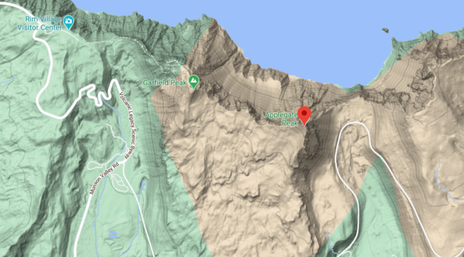

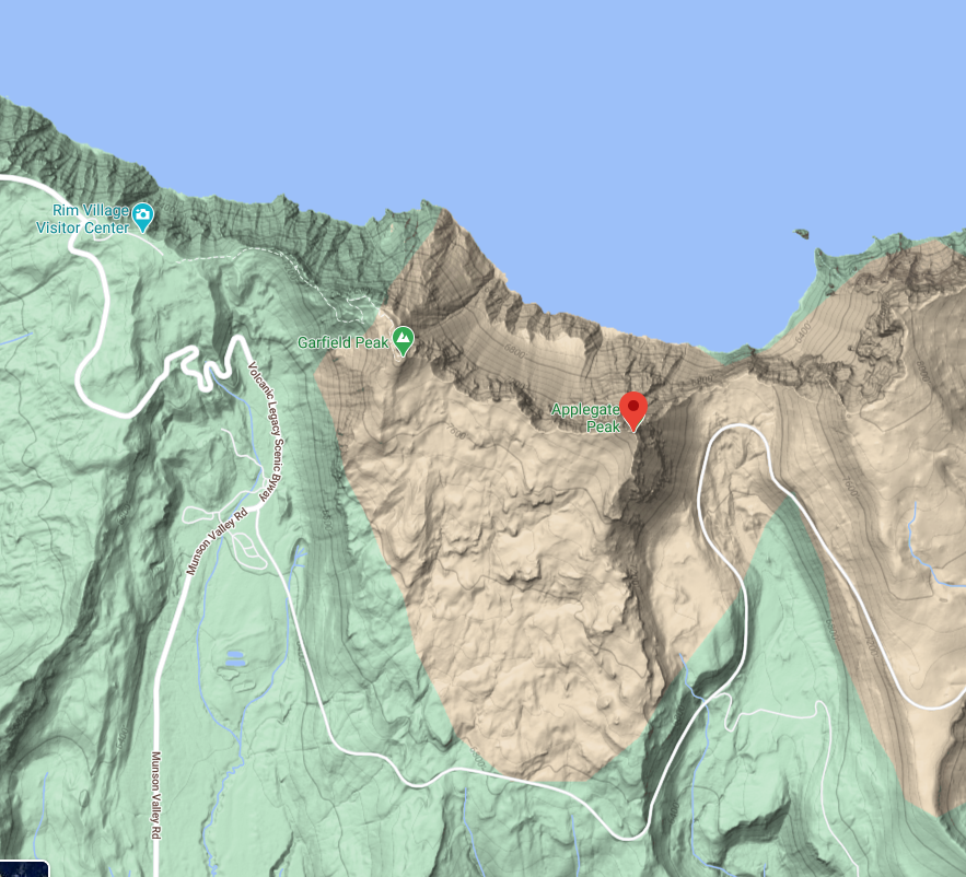
Applegate Peak – Prominent Geological Features of Crater Lake National Park
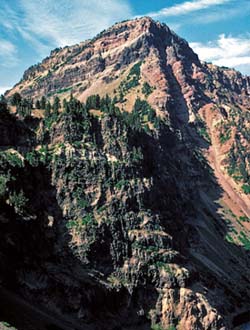
View southwest of Applegate Peak and 280-meter-high cliff below Sun Notch from Phantom Cone, Scientific Investigations Map 2832, Sheet 3 of 4, Crater Lake National Park, Geologic Map of Mount Mazama and Crater Lake Caldera, Oregon (2008), by Charles R. Bacon.
This peak was named for Oliver C. Applegate (an early Oregon pioneer) by a 1872 group of visitors to Crater Lake. Applegate Peak caps the prominent rock wall of the west side of Sun Notch at the caldera rim.
View southwest of Applegate Peak and 280-m-high cliff below Sun
Notch from phantom cone (Panorama K). Hydrothermally altered flowtop breccia weathers tan; whereas, dense lava flow interiors are dark, giving cliffs a horizontally striped appearance. Lava outcrop at lake level is andesite of phantom cone (unit apn; 403±12 ka nearby). Lava flows above phantom cone and below prominent buff-colored sedimentary layer near top of cliff are dacite of Chaski Bay (unit db; ~350–380 ka). Highest lava flows are andesite of Kerr Notch (unit ak; ~300–340 ka).
Slope below rim at Sun Notch is proximal lithic-rich climactic ignimbrite (unit cb) overlying a few meters of climactic and Llao Rock pumice-fall deposits (units cp and rhp; not visible). Andesite of Applegate Peak (unit aa; ca. 210–270 ka) lava flows and breccia form their namesake and high cliffs at right. Two steep gullies in shadows below Applegate Peak follow traces of caldera-wall-parallel normal faults. Talus forming slope in lower foreground was shed from Dutton Cliff.
Other pages in this section
*** previous title *** --- *** next title ***