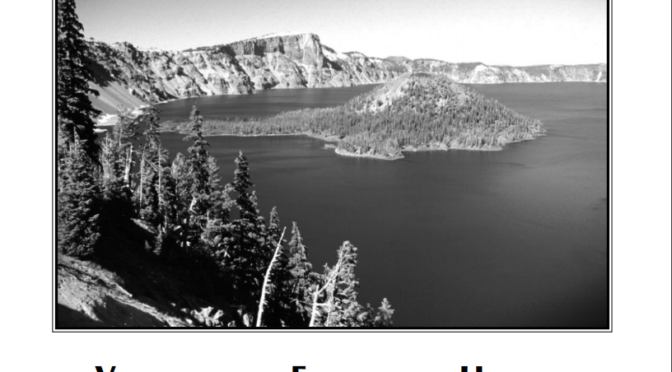

Volcano and Earthquake Hazards in the Crater Lake Region, Oregon
Complete Report (PDF) earthquake-hazard-report

Illustrations
Plate 1. Map showing hazard zones, faults, and volcanic vents in the Crater Lake region .......... In pocket
Figure 1. Map showing faults and volcanic vents in the Crater Lake region
- Generalized geologic map of Mount Mazama and vicinity
- Geologic map of Crater Lake caldera floor
- Map showing earthquake epicenters and magnitudes
Tables
Table 1. Volume and flow properties of a hypothetical lahar at Crater Lake based on events at Mount St. Helens, Washington, and Raupehu Volcano, New Zealand
- Numbers of known basalt, basaltic andesite, and andesite volcanic vents and eruptive episodes outside Crater Lake caldera and exclusive of Mount Mazama between approximately latitudes 42°48’ and 43°05’
- Seismicity in the vicinity of Crater Lakre, Oregon
- Fault offsets (down-to-the-east) and average long-term slip rates along Annie Spring and Red Cone Spring faults
- Maximum earthquake magnitudes in the Crater Lake region
- Approximate minimum areas, thicknesses, and volumes of probable landslides at Crater Lake
* Technical terms which appear in bold italics in this report are defined in the glossary. A more comprehensive glossary, descriptions of types of volcanic activity in the Cascades, and more information on volcanoes can be found at the USGS Cascades Volcano Observatory World Wide Web site. URL: http://vulcan.wr.usgs.gov The book by Decker and Decker (1989) gives an illustrated, non -technical overview of volcanoes. The book by Francis (1993) is more technical and includes many case histories.
Other pages in this section
*** previous title *** --- *** next title ***