
Discovery Point Trail – Crater Lake National Park
| Time: 1 hour
Difficulty: Easy Length: 1.3 mi (2.1 km) Elevation: 7093 – 7119* ft (2162 – 2170* m) |
Trailhead coordinates:Latitude: N +42° 54.72 or 42.91205
Longitude: W -122° 08.80 or -122.14674 Altitude: 7119* ft (2170* m) |
| Highlight: views of Crater Lake from forested rim | |
*West rim village †Discovery Point
REI Trails Project partners with Crater Lake Institute to produce their trails app. Click the map below, get the app – then come back, we offer more.
Trail Description
|
Golden-mantled Ground Squirrels are a common site along the rim, Photo by Robert Mutch |

This is an easy trail to follow as it meanders along the rim to the spot at which some would-be miners first came upon Crater Lake in 1853. It is one of the best family hikes for people of all ages.
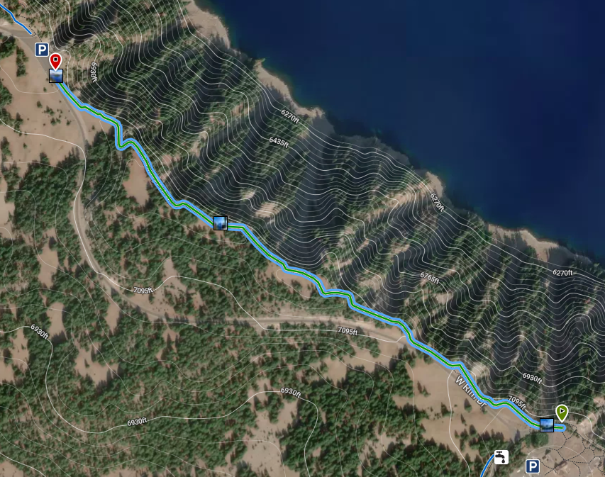
The Discovery Point Trail leads northwestward from the Rim Village parking area. The trail begins at an elevation of 7,050 feet and gains no more than 100 feet along its route. From the trailhead it contours the rim of Crater Lake nearly one and a half miles. Most of the route parallels West Rim Drive.
Much of the rim is forested with Mountain hemlock and whitebark pine. There are several openings from which to view the lake, it’s rim, and Wizard Island. Be careful of the steep edges.
Trailhead location: West end of Rim Village, where the paved walk becomes a dirt path. There is no designated trailhead.
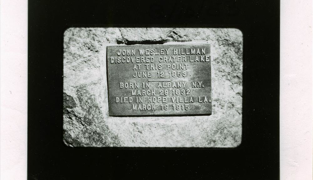
Nature Note: Gold prospector John Wesley Hillman first spotted Crater Lake from this point in 1853.
Seasonal Information: Expect the trail to be covered in snow from October to early July, however, conditions vary somewhat from year to year. See Crater Lake Current Conditions for more information.
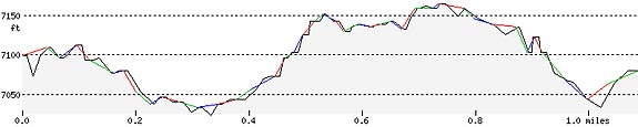
Discovery Point Trail Elevation Profile
Related Maps
Digital USGS topographic maps (PDF files) – the following maps are relevant to the Discovery Point trail. See more Crater Lake Institute online USGS digital maps.
| Series | Name | Year | Scale | Contour Interval | File Size |
| USGS 7.5′ | Crater Lake West | 1985 | 1:24,000 | 40 ft | usgs-crater-lake-west-7.5 |
| USGS 30′ x 60′ | Crater Lake | 1989 | 1:100,000 | 50 m | usgs-crater-lake-30-minute |
| USGS 30′ x 60′ | Diamond Lake | 1978 | 1:100,000 | 50 m | usgs-diamond-lake-30-minute |
| USGS 1° x 2° | Klamath Falls | 1970 | 1:250,000 | 200 ft | usgs-klamath-falls-1-2 |
| USGS 1° x 2° | Medford | 1976 | 1:250,000 | 200 ft | usgs-medford-1-2 |
| USGS 1° x 2° | Roseburg | 1970 | 1:250,000 | 200 ft | usgs-medford-1-2 |
|
Please remember to practice “leave no trace outdoor ethics” when you are out on Crater Lake National Park’s trails…and have fun! |
Other pages in this section
- Pacific Crest Trail
- Anderson Bluffs Trail
- Anne Creek Canyon Trail
- Anne Springs Cutoff Trail
- Bald Crater Loop Trail
- Bert Creek Trail
- Boundary Springs Trail
- Castle Crest Wildflower Trail
- Cleatwood Cove Trail
- Crater Peak Trail
- Dutton Creek Trail
- Fumarole Bay Trail
- Garfield Peak Trail
- Godfrey Glenn Trail
- Lightning Spring Trail
- Llaos Hallway
- Mount Scott Trail
- Park Headquarters Historic Trail
- Pinnacles Valley Trail
- Plaikni Falls Trail
- Pumice Flat Trail
- Stuart Falls Trail
- Sun Notch Trail
- Union Peak Trail
- Watchman Peak Trail
- Wizard Island Summit Trail
- Hiking Rules and Regulations
- Best Trails at Crater Lake