Bald Crater Loop Trail – Crater Lake National Park
Difficulty: Moderate
Length: 13.9 mile loop trail
Elevation: 5233 ft (1595 m)
REI Trails Project partners with Crater Lake Institute to produce their trails app. Click the map below, get the app – then come back, we offer more.
|
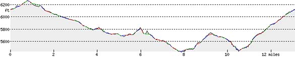
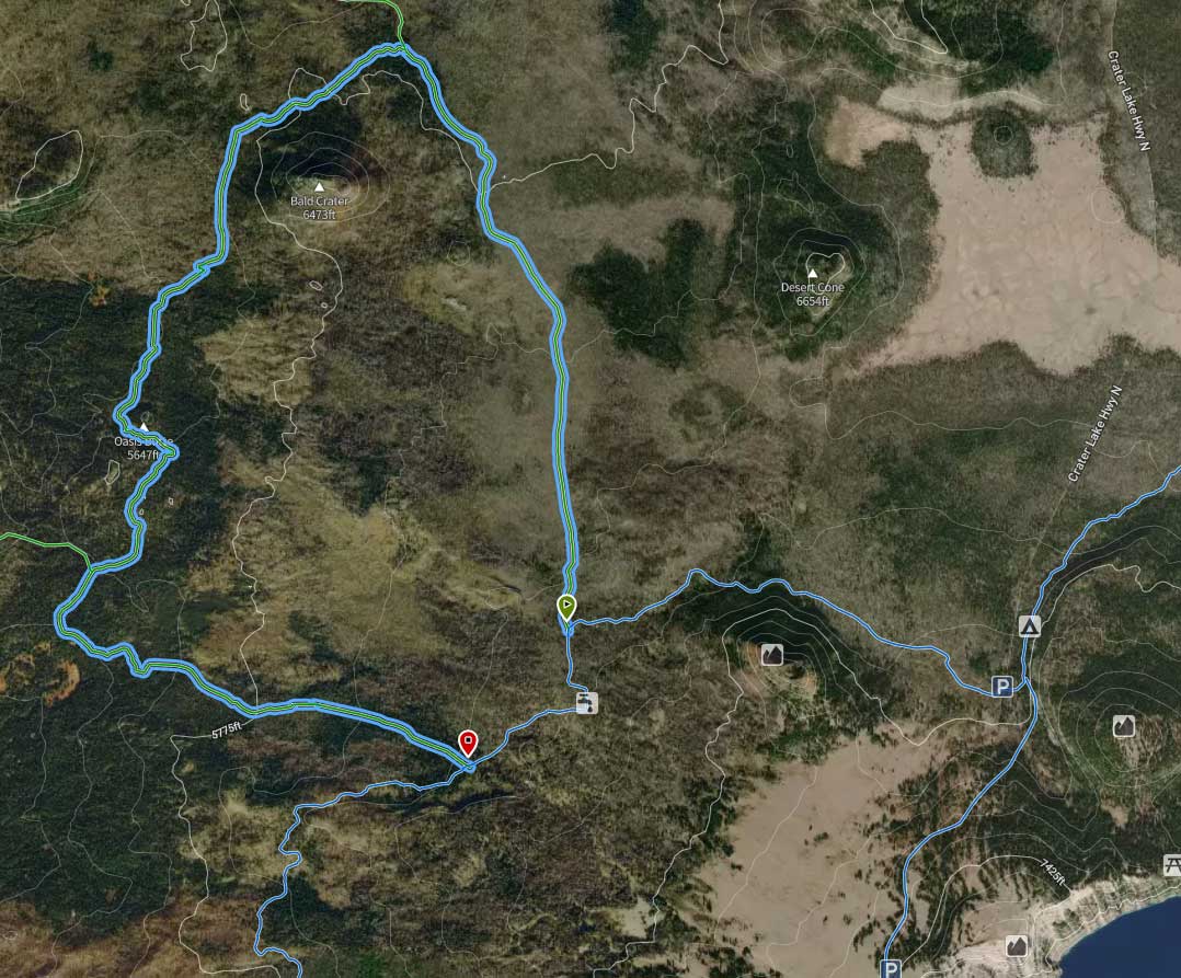
Trailhead coordinates:Latitude: N +42° 05.45 or 42.989Longitude: W -122° 12.105 or -122.202Altitude: 5233 ft (1595 m) Trail DescriptionBert Creek Trail Pacific Crest Trail (southeast) Pacific Crest Trail Boundary Springs Trail This large circular loop trail is a great hike as well as a hub that intersects with the Boundary Springs trail to the north, the Bert Creek trail to the southwest, and the Pacific Crest Trail (PCT) to the southeast. So, while many will not hike this trail in it’s entirety, they will hike portions of it on their way to other trails. The overall elevational changes are not great, but, there are some up and down areas. Lodgepole pine is a dominant overstory forest cover for a large portion of this trail. Trailhead location: Many hikers will access this trail from different points, so, the coordinates for the intersections with the different trails and the Bald Crater Loop Trail are given in the column to the right. Seasonal Information: Expect the trail to be covered in snow from October to early July, however, conditions vary somewhat from year to year. See Crater Lake Current Conditions for more information. REI’s Hiking Project partners with Crater Lake Institute to provide exceptional trail information:
Bald Crater Loop Trail Elevation Profile
Related Maps Digital USGS topographic maps (PDF files) – the following maps are relevant to the Bald Crater Loop trail. See more Crater Lake Institute online USGS digital maps.
Other pages in this section
|