
Annie Spring Cutoff Trail – Crater Lake National Park
Difficulty: Moderate
Length: .65 miles (1.04 km)
Elevation: 6381 – 6053 ft (1945 – 1845 m)
REI Trails Project partners with Crater Lake Institute to produce their trails app. Click the map below, get the app – then come back, we offer more of everything about Crater Lake than any other website.
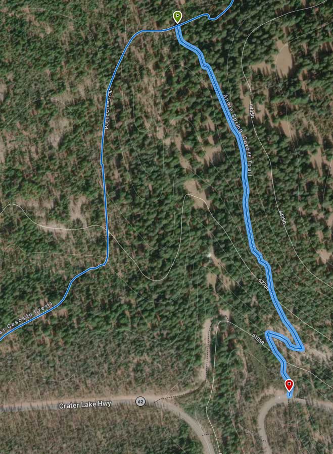
Trailhead coordinates (at PCT intersection):
Latitude: N +42° 52.777 or 42.8796
Longitude: W -122° 10.362 or -122.1727
Altitude: 6381* ft (1945* m)
Trail Description
|
This short trail is a connector between the Pacific Crest Trail (PCT) and Mazama Village and has recently been rerouted upslope . PCT hikers often need to access Mazama Village for such basic services as hot showers, water, food, and etc. The trail is a gradual decline in elevation from the PCT intersection to Mazama Village as it passes through a fairly open lodgepole pine and mountain hemlock forest.
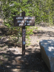
Trailhead location: The southern portion of this trail is located on the western side of the Munson Valley road just a few hundred meters past the south entrance (Annie Springs) station.
Nature Note: Annie Springs was named for Annie Gaines, the young sister-in-law of the Fort Klamath commander, Capt. William Rinehart. In 1865, Annie, Capt. Rinehart, and some of his soldiers descended to Crater Lake and Annie became the first known white woman to do so.
Seasonal Information: Expect the trail to be covered in snow from October to early July, however, conditions vary somewhat from year to year. See Crater Lake Current Conditions for more information.
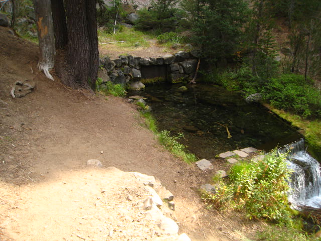
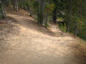
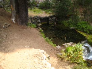
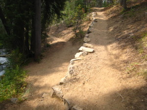
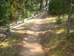
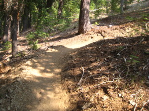
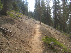
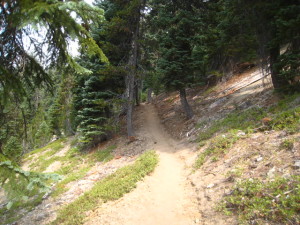
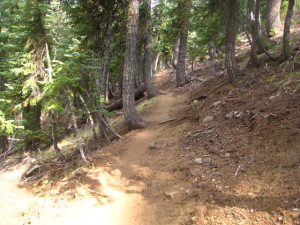
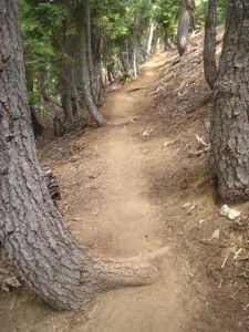
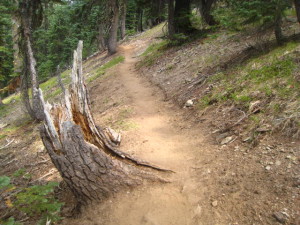
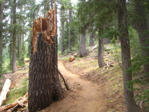
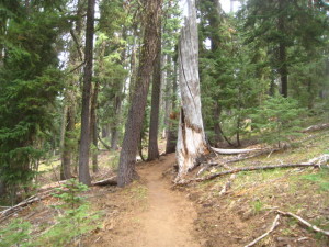
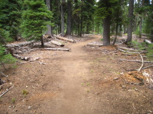
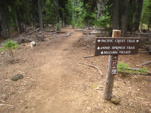
Below are some photos of the ‘new’ rerouted trail provided by Jennifer Gifford, CRLA Trails Supervisor in spring 2016. Top photo is lower trailhead. Bottom photo is junction with the PCT
Related Maps
Digital USGS topographic maps (PDF files) – the following maps are relevant to the Bald Crater Loop trail. See more Crater Lake Institute online USGS digital maps.
| Series | Name | Year | Scale | Contour Interval | File Size |
| USGS 7.5′ | Crater Lake West | 1985 | 1:24,000 | 40 ft | usgs-crater-lake-west-7.5 |
| USGS 7.5′ | Pumice Desert West | 1985 | 1:24,000 | 40 ft | usgs-pumice-desert-west-7.5 |
| USGS 30′ x 60′ | Crater Lake | 1989 | 1:100,000 | 50 m | usgs-crater-lake-30-minute |
| USGS 30′ x 60′ | Diamond Lake | 1978 | 1:100,000 | 50 m | usgs-diamond-lake-30-minute |
| USGS 1° x 2° | Klamath Falls | 1970 | 1:250,000 | 200 ft | usgs-klamath-falls-1-2 |
| USGS 1° x 2° | Medford | 1976 | 1:250,000 | 200 ft | usgs-medford-1-2 |
| USGS 1° x 2° | Roseburg | 1970 | 1:250,000 | 200 ft | usgs-roseburg-1-2 |
|
Please remember to practice “leave no trace outdoor ethics” when you are out on Crater Lake National Park’s trails…and have fun! |
Other pages in this section
- Pacific Crest Trail
- Anderson Bluffs Trail
- Anne Creek Canyon Trail
- Bald Crater Loop Trail
- Bert Creek Trail
- Boundary Springs Trail
- Castle Crest Wildflower Trail
- Cleatwood Cove Trail
- Crater Peak Trail
- Discovery Point Trail
- Dutton Creek Trail
- Fumarole Bay Trail
- Garfield Peak Trail
- Godfrey Glenn Trail
- Lightning Spring Trail
- Llaos Hallway
- Mount Scott Trail
- Park Headquarters Historic Trail
- Pinnacles Valley Trail
- Plaikni Falls Trail
- Pumice Flat Trail
- Stuart Falls Trail
- Sun Notch Trail
- Union Peak Trail
- Watchman Peak Trail
- Wizard Island Summit Trail
- Hiking Rules and Regulations
- Best Trails at Crater Lake