
Mount Scott Trail – Crater Lake National Park
| Time: 3 hours
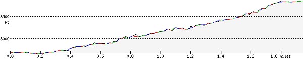
Difficulty: Difficult Length: 2.5 mi (4.02 km) Elevation: 7680 – 8832 ft (2341 – 2692 m) |
Trailhead coordinates:
Latitude: N +42° 55.74 or 42.92904 Longitude: W -122° 01.80 or -122.03006 Altitude: 7680 ft (2341 m) |
| Highlight: panoramic views; Highest point in the park, fire lookout, lake view, panoramic view of High Cascades, Klamath Basin, and Eastern Cascades; alpine wildflowers | |
REI Trails Project partners with Crater Lake Institute to produce their trails app. Click the map below, get the app – then come back, we offer more.
Trail Description
|
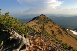
Mount Scott summit ridge, looking south, Photo by Robert Mutch |
In a park with spectacular views, Mount Scott has some of the most awe-inspiring views. This is also a fantastic alpine wildflower trail.
Despite the length and high altitude to which this trail reaches, it is relatively gradual for it’s entire length. In it’s first .25 mile the trail passes through a relatively open, and flat, pumice field with great closeup views of the northern face of Mount Scott. The next .75 miles of the trail gradually rises along Mount Scott’s west and southwest flanks through a forest dominated by mountain hemlock, with some whitebark pines and a few Shasta red firs.
The trail then breaks into a more open pumice and forested habitat as it begins to climb more steeply, and switchback, up the south face of Mount Scott before ascending to the summit ridge. There are a couple of spectacular viewing points as the trail switchbacks at the edge of Mount Scott’s collapsed northern face.
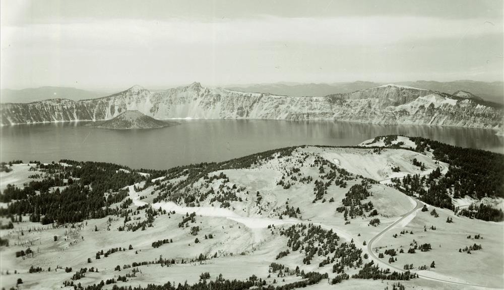
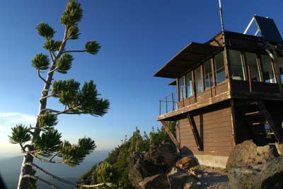
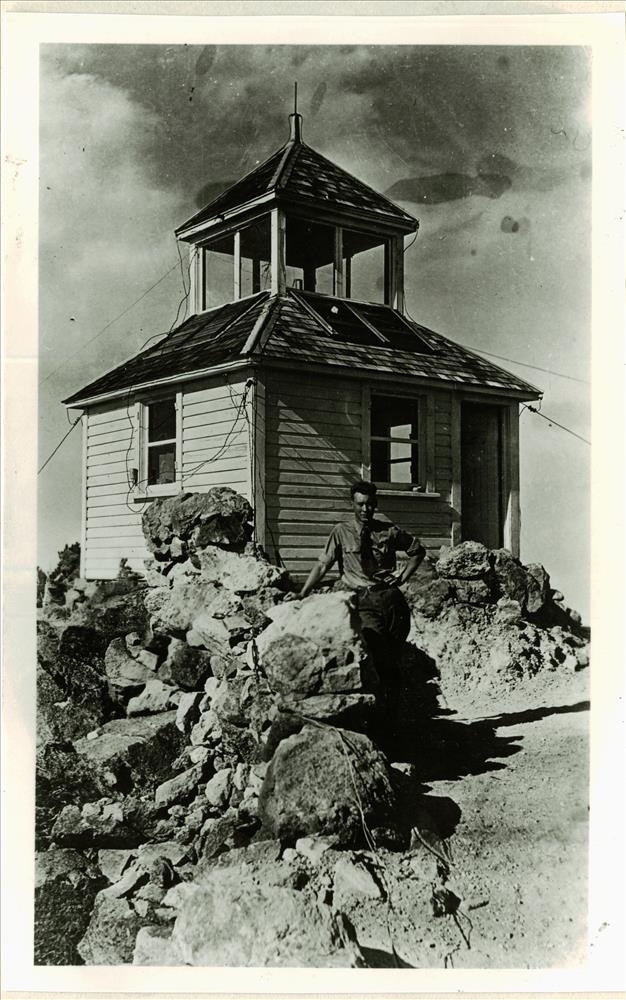
The summit ridge, .2 miles long, is fairly flat. The fire lookout (built in 1926) lies at the north end of the ridge. To the south can be seen the Klamath Basin and other southern High Cascades points and to the north (past the fire lookout) can be seen.
Be very sure to take a coat and other warm weather gear as the top is often windy, cold, and the weather can turn very quickly…even during the late summer months.
Trailhead location: East Rim Drive, 14 miles (22.5 km) east of Park Headquarters.
Nature Note: Mt. Scott is the park’s highest peak-8,929 feet (2,721 meters) in elevation; mid- to late July is the peak blooming period for Mount Scott’s high alpine wildflowers.
Historic Note: Mount Scott is name for Levi Scott (1797 – 1890), an Oregon pioneer who helped lay the Applegate Trail, served in the Oregon Territorial Legislature, the Oregon Constitutional Convention, and founded Scottsburg, Oregon.
Seasonal Information: Expect the trail to be covered in snow from October to late July, however, conditions vary somewhat from year to year.
Related Maps
Digital USGS topographic maps (PDF files) – the following maps are relevant to the Mount Scott trail. See more Crater Lake Institute online USGS digital maps.
| Series | Name | Year | Scale | Contour Interval | File |
| USGS 7.5′ | Crater Lake East | 1985 | 1:24,000 | 40 ft | usgs-crater-lake-east-7.5 |
| USGS 30′ x 60′ | Crater Lake | 1989 | 1:100,000 | 50 m | usgs-crater-lake-30-minute |
| USGS 30′ x 60′ | Diamond Lake | 1978 | 1:100,000 | 50 m | usgs-diamond-lake-30-minute |
| USGS 1° x 2° | Klamath Falls | 1970 | 1:250,000 | 200 ft | usgs-klamath-falls-1-2 |
| USGS 1° x 2° | Medford | 1976 | 1:250,000 | 200 ft | usgs-medford-1-2 |
| USGS 1° x 2° | Roseburg | 1970 | 1:250,000 | 200 ft | usgs-roseburg-1-2 |
|
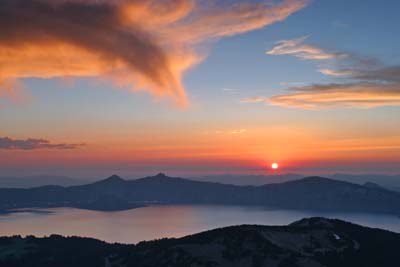
Crater Lake sunset from Mount Scott summit, facing west (West Rim Drive), photo by Robert Mutch |
|
Mount Scott fire lookout with Whitebark pine at left foreground, facing north, photo by Robert Mutch |
|
Please remember to practice “leave no trace outdoor ethics” when you are out on Crater Lake National Park’s trails…and have fun! |
Other pages in this section
- Pacific Crest Trail
- Anderson Bluffs Trail
- Anne Creek Canyon Trail
- Anne Springs Cutoff Trail
- Bald Crater Loop Trail
- Bert Creek Trail
- Boundary Springs Trail
- Castle Crest Wildflower Trail
- Cleatwood Cove Trail
- Crater Peak Trail
- Discovery Point Trail
- Dutton Creek Trail
- Fumarole Bay Trail
- Garfield Peak Trail
- Godfrey Glenn Trail
- Lightning Spring Trail
- Llaos Hallway
- Park Headquarters Historic Trail
- Pinnacles Valley Trail
- Plaikni Falls Trail
- Pumice Flat Trail
- Stuart Falls Trail
- Sun Notch Trail
- Union Peak Trail
- Watchman Peak Trail
- Wizard Island Summit Trail
- Hiking Rules and Regulations
- Best Trails at Crater Lake